A recording of a ppresentation to the South Wales Geologists Association A review of some of the best fossil preservation sites in the world (Lagerstatten) by John Nudds Co-Author of the book on this subject Evolution of Fossil Ecosystems and Fossil Ecosystems of North America
Author: ExGeo
Jeremy Hucker – dealing with the Legacy of Coal Mining across South Wales
Jeremy Hucker gives a brief introduction to coal and coalfields before getting on to the legacy and risks, and how we identify and mitigate those risks
James Creswell – The Geology of Antarctica
A personal view by James Creswell
December 2023 Newsletter
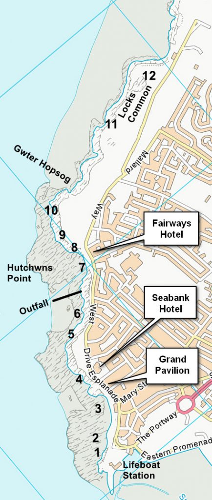
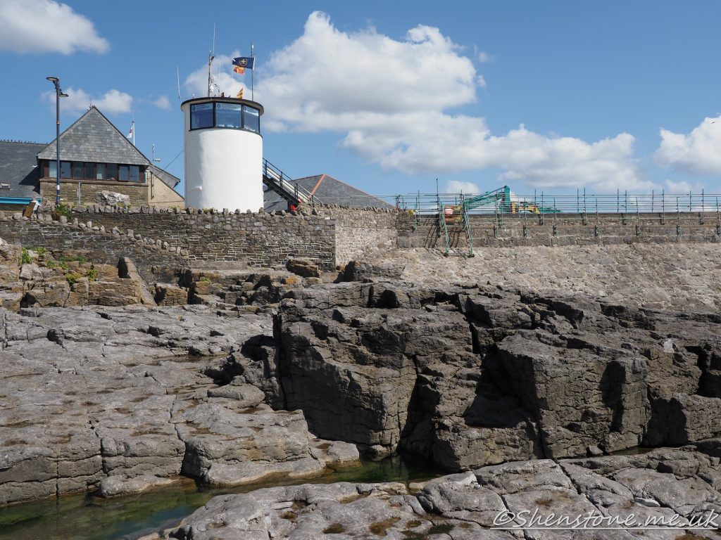
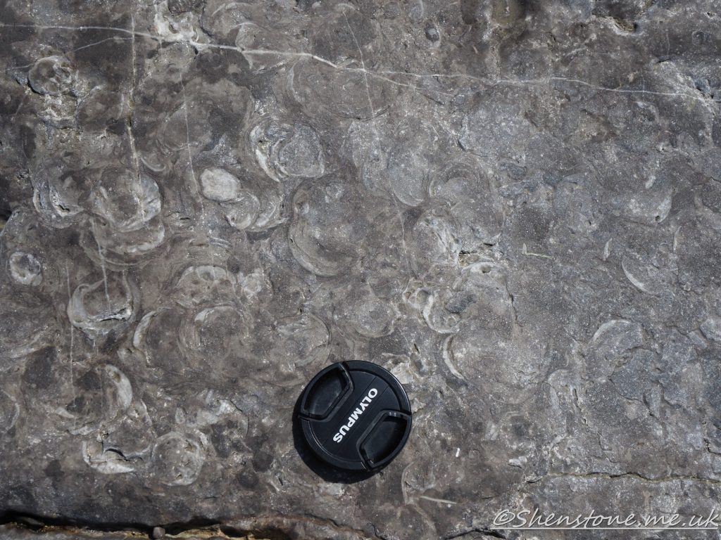
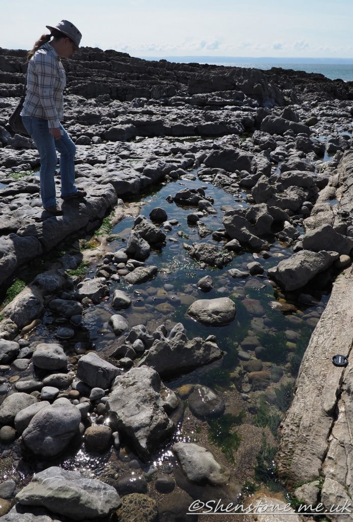
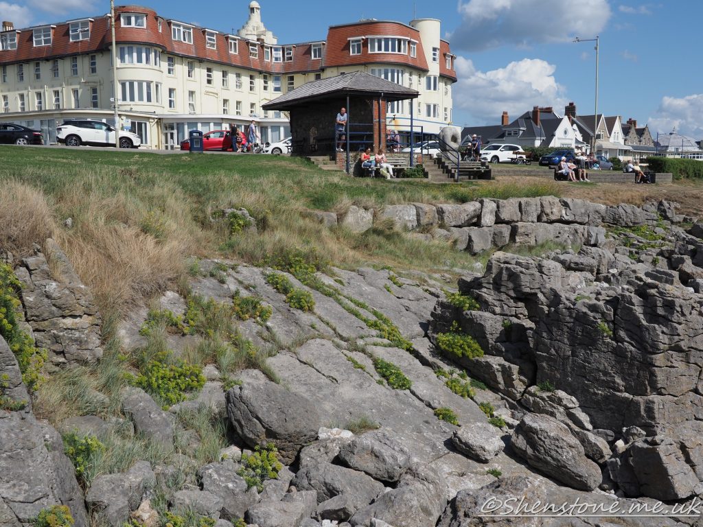
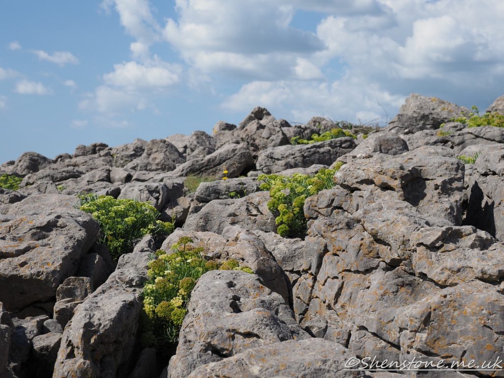
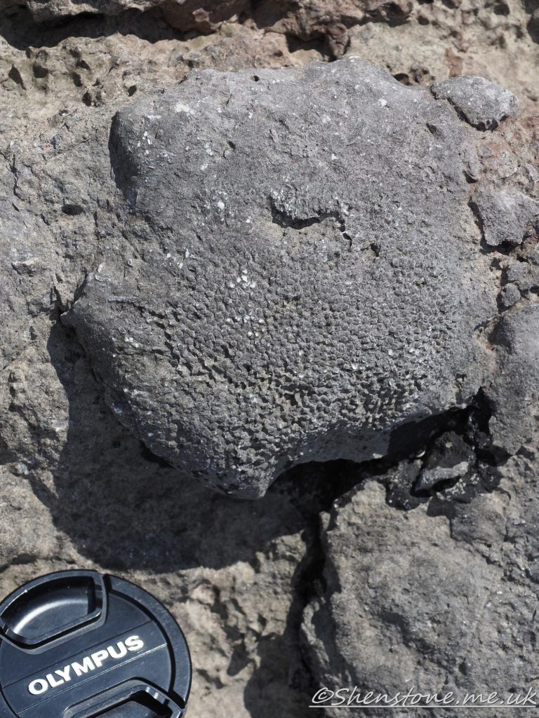
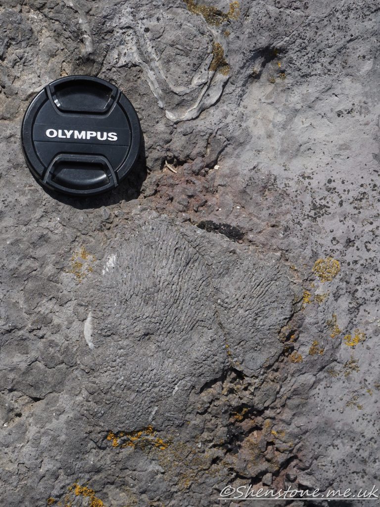
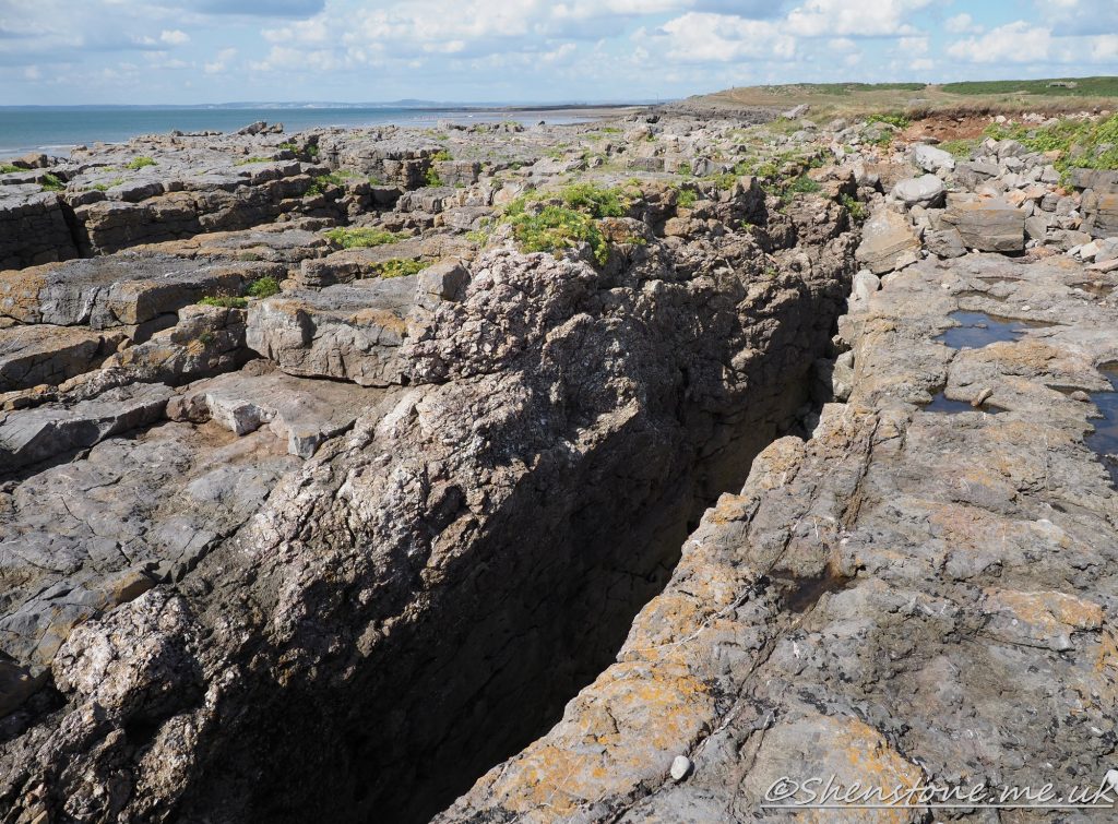
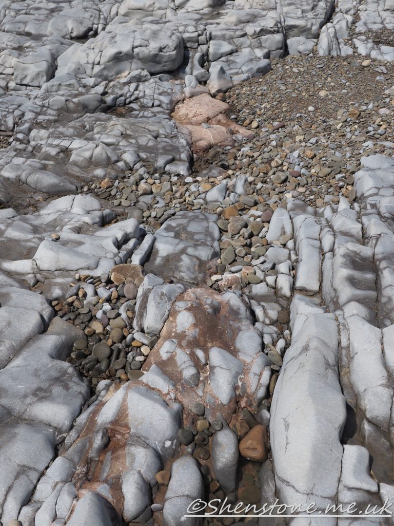
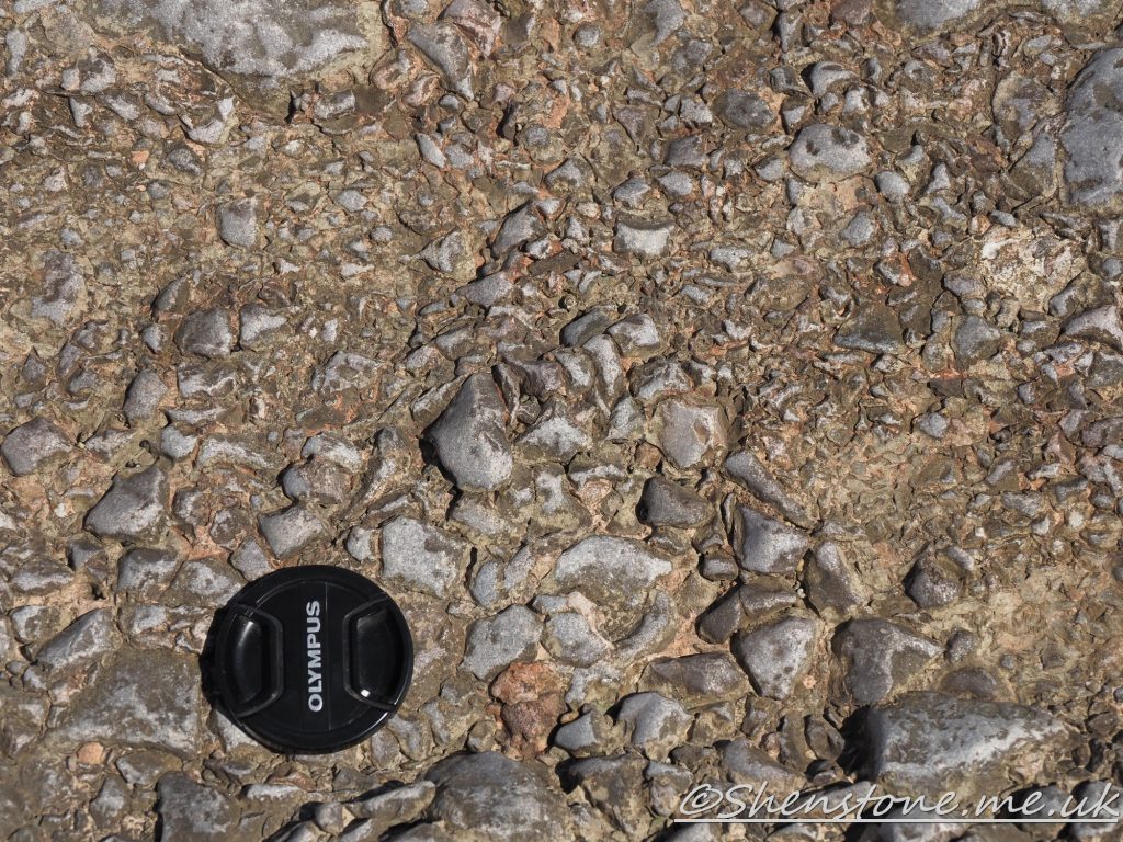
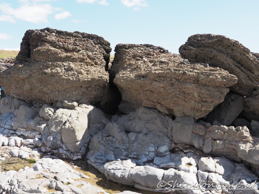
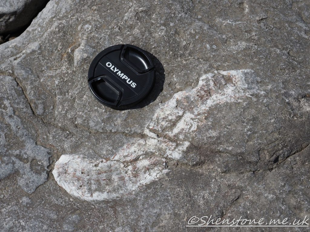
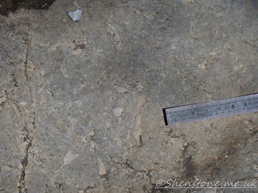
Geological Walk at Porthcawl
This is some additional information and pictures to support the geology walk at Porthcawl. Take a look at the descriptions under each picture to see more information
The Localities mentioned on this post relate to the map which is included in the leaflet PDF and is repeated here to make this page easier to read. For more information and descriptions of all the localities and the start point, parking etc. please see the leaflet
To download and print this walk, please open / download the PDF version here
•BGS Geology Viewer is a free smartphone app to view geological maps of Britain wherever you go https://www.bgs.ac.uk/technologies/apps/igeology-app/
We hope you enjoyed this short tour of Porthcawl. If you’d like to learn more about our local geology, take a look at other pages on the South Wales Geologists’ Association website: www.swga.org.uk
Global Tonga tsunami explained by a fast-moving atmospheric source – talk by Ricardo Ramalho
If you missed our lecture by Ricardo Ramalho you can watch it here:
Opinions expressed by authors and services offered by advertisers are not specifically endorsed by the South Wales Geologists' Association
September 2023 Newsletter
http://swga.org.uk/wp-content/uploads/2023/09/SWGA-Newsletter-September-2023.pdf
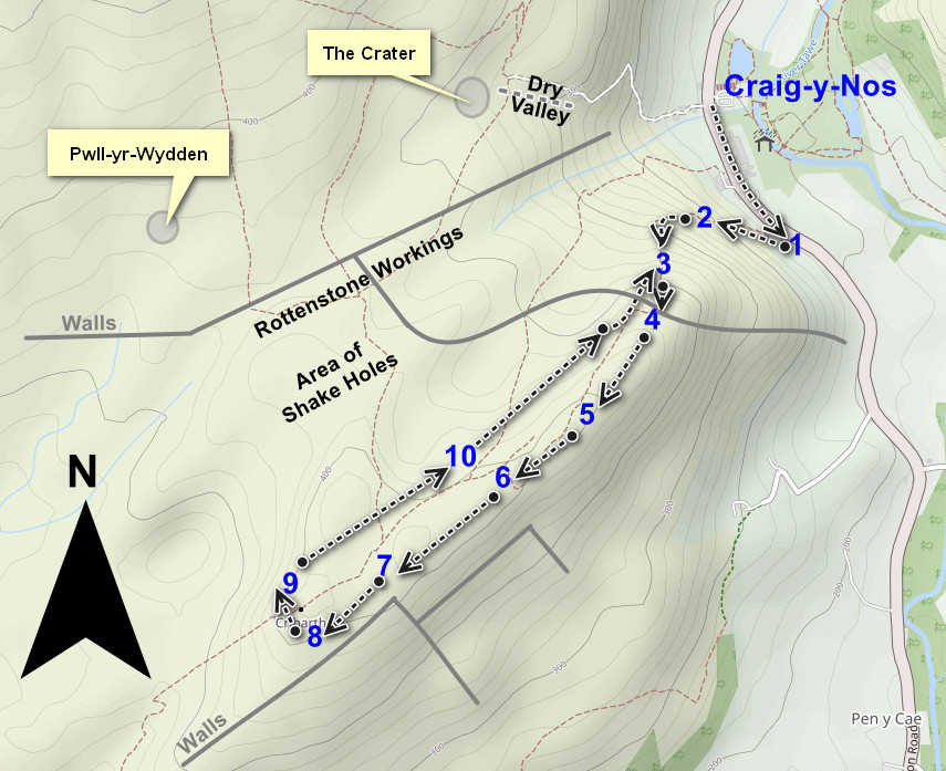
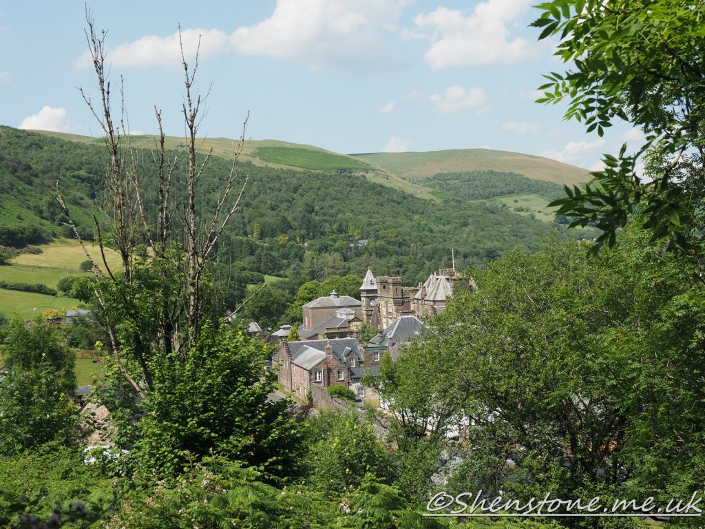
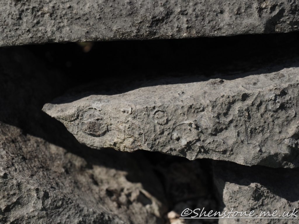
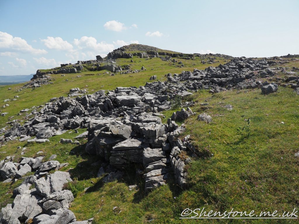
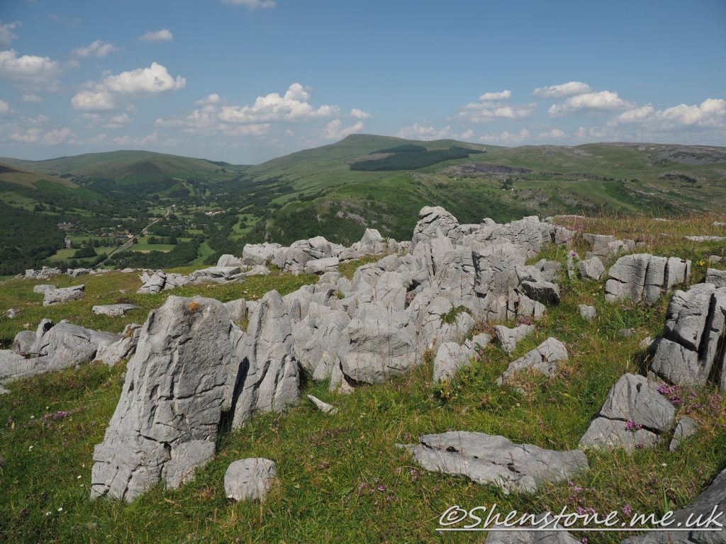
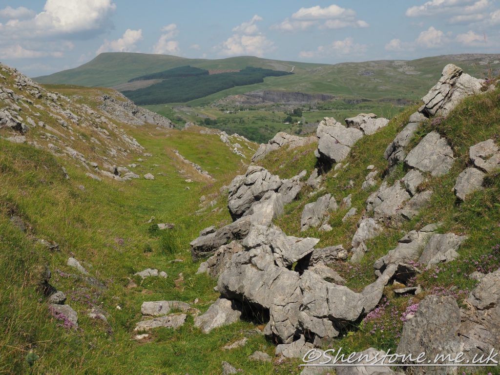
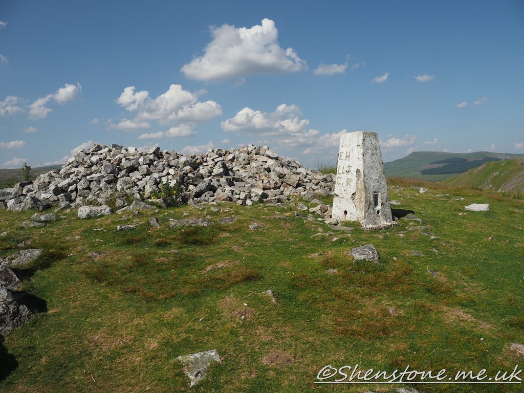
Geological Walk on Cribarth from Craig-y-Nos
This is some additional information and pictures to support the geology walk at Cribarth from Craig-y-Nos. Take a look at the descriptions under or above each picture to see more information
The Localities mentioned on this post relate to the map which is included in the leaflet PDF and is repeated here to make this page easier to read. For more information and descriptions of all the localities and the start point, parking etc. please see the leaflet
To download and print the leaflet version of this walk, please open / download the PDF version here

BGS Geology Viewer is a free smartphone app to view geological maps of Britain wherever you go https://www.bgs.ac.uk/technologies/apps/igeology-app/
We hope you enjoyed this short tour of Cribarth from Craig-y-Nos. If you’d like to learn more about our local geology, take a look at other pages on the South Wales Geologists’ Association website: www.swga.org.uk
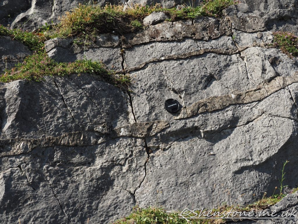
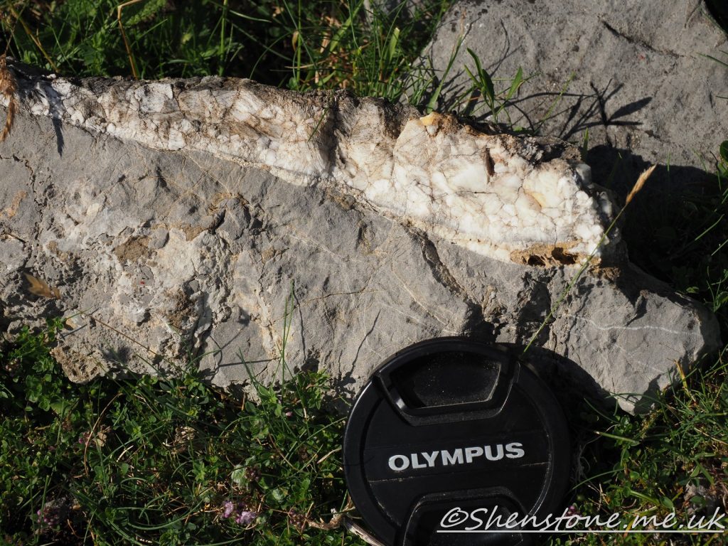
Geological Walk at Ogmore-by-Sea, Vale of Glamorgan
This is some additional information and pictures to support the geology walk at Ogmore-by-Sea. Take a look at the descriptions under each picture to see more information
The Localities mentioned on this post relate to the map which is included in the leaflet PDF and is repeated here to make this page easier to read. For more information and descriptions of all the localities and the start point, parking etc. please see the leaflet
To download and print this walk, please open / download the PDF version here
•BGS Geology Viewer is a free smartphone app to view geological maps of Britain wherever you go https://www.bgs.ac.uk/technologies/apps/igeology-app/
We hope you enjoyed this short tour of Ogmore-by-Sea, Vale of Glamorgan. If you’d like to learn more about our local geology, take a look at other pages on the South Wales Geologists’ Association website: www.swga.org.uk
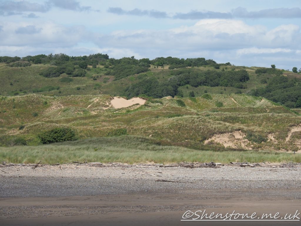
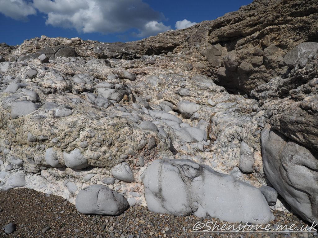
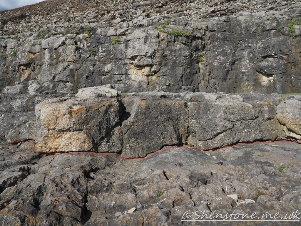
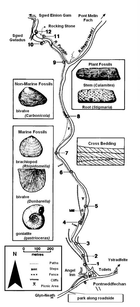
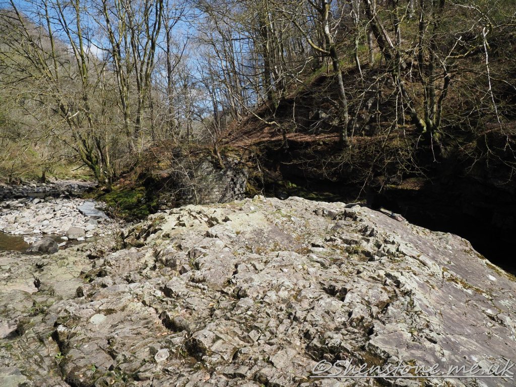
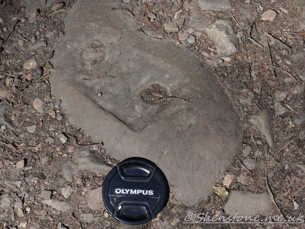
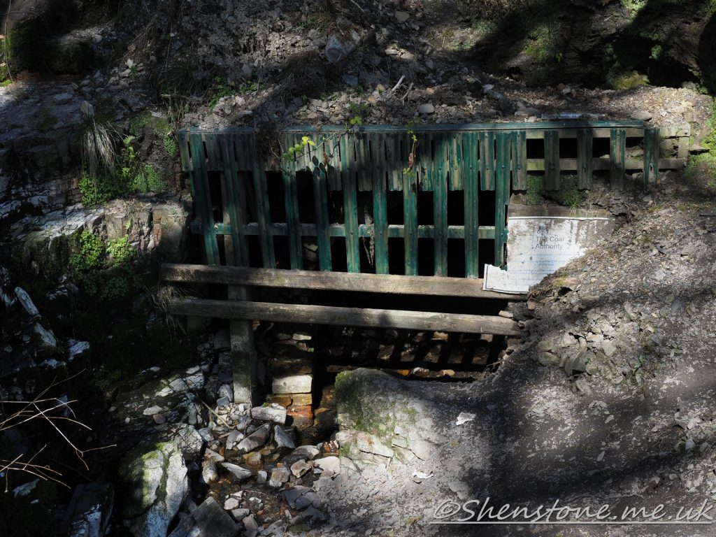
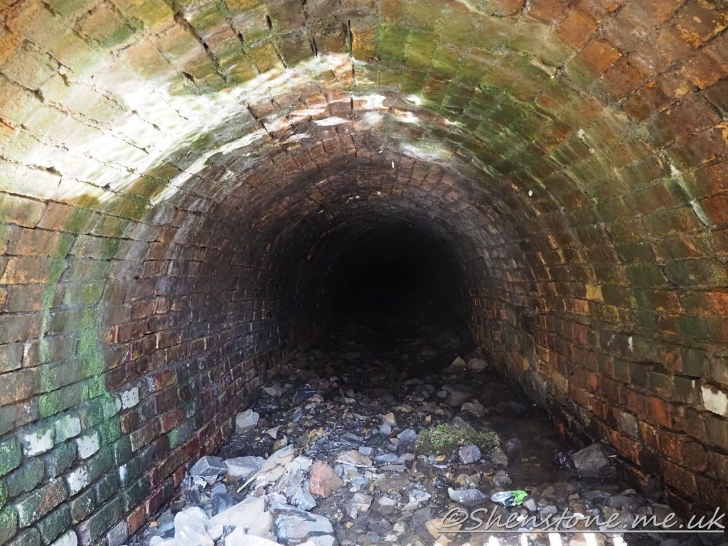
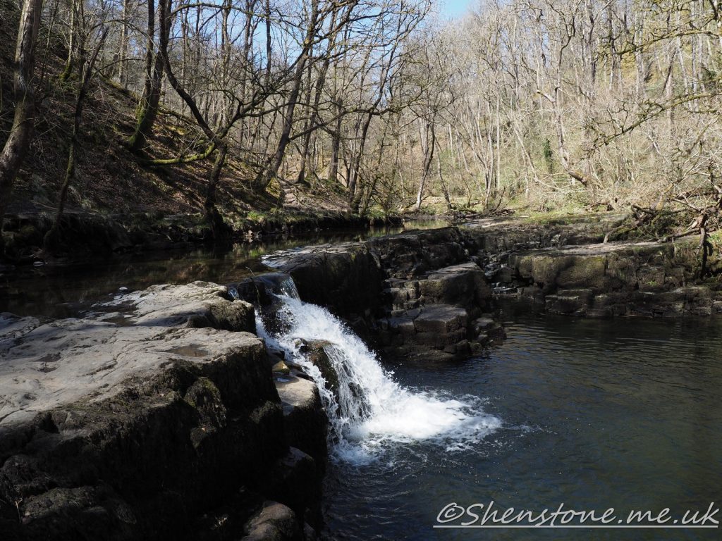
Geological Walk at Pontneddfechan: The Afon Nedd and Sgwd Gwladus
This is some additional information and pictures to support the geology walk at Pontneddfechan. Take a look at the descriptions under each picture to see more information
The Localities mentioned on this post relate to the map which is included in the leaflet PDF and is repeated here to make this page easier to read. For more information and descriptions of all the localities and the start point, parking etc. please see the leaflet
To download and print this walk, please open / download the PDF version here
A useful addition to your walk is the BGS Geology Viewer which is a free smartphone app to view geological maps of Britain wherever you go https://www.bgs.ac.uk/technologies/apps/igeology-app/
We hope you enjoyed this short tour at Pontneddfechan. If you’d like to learn more about our local geology, take a look at other pages on the South Wales Geologists’ Association website: www.swga.org.uk