This is some additional information and pictures to support the geology walk at Barry Island. Take a look at the descriptions under each picture to see more information
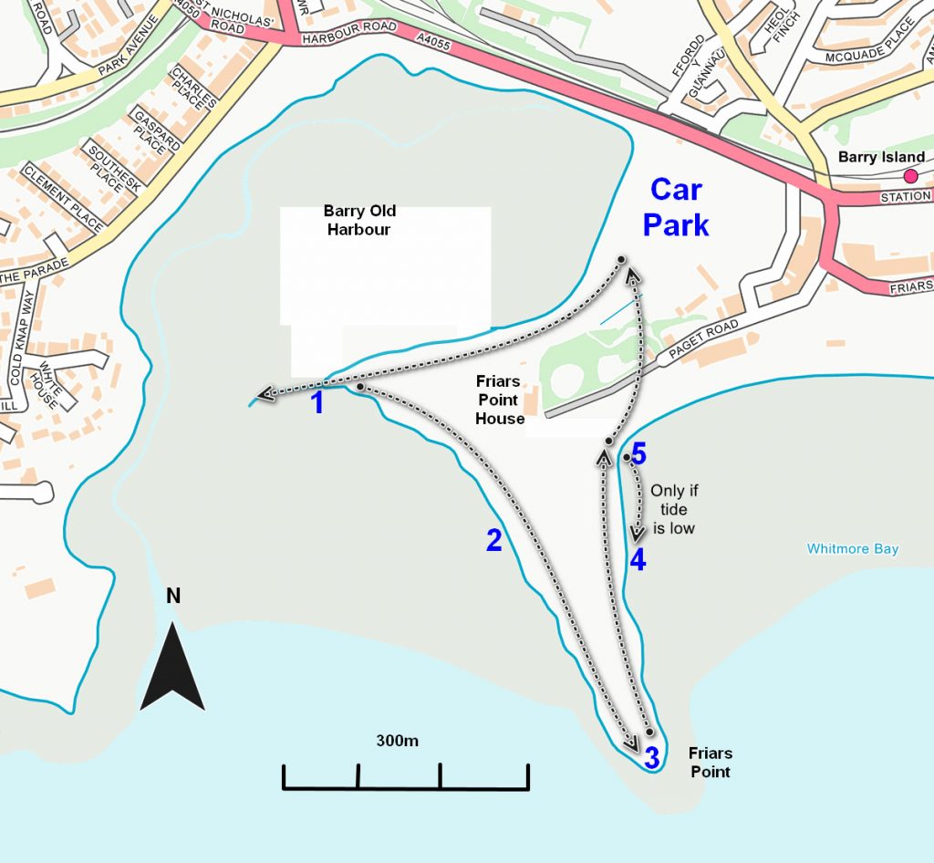
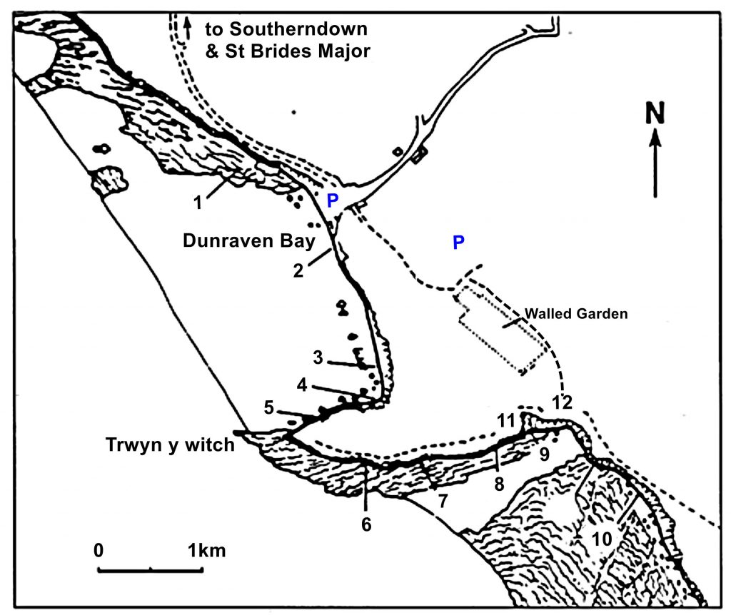
The Localities mentioned on this post relate to the map which is included in the leaflet PDF and is repeated here to make this page easier to read. For more information and descriptions of all the localities and the start point, parking etc. please see the leaflet
Barry Island Walk Map
To download and print this walk, please open / download the PDF version here
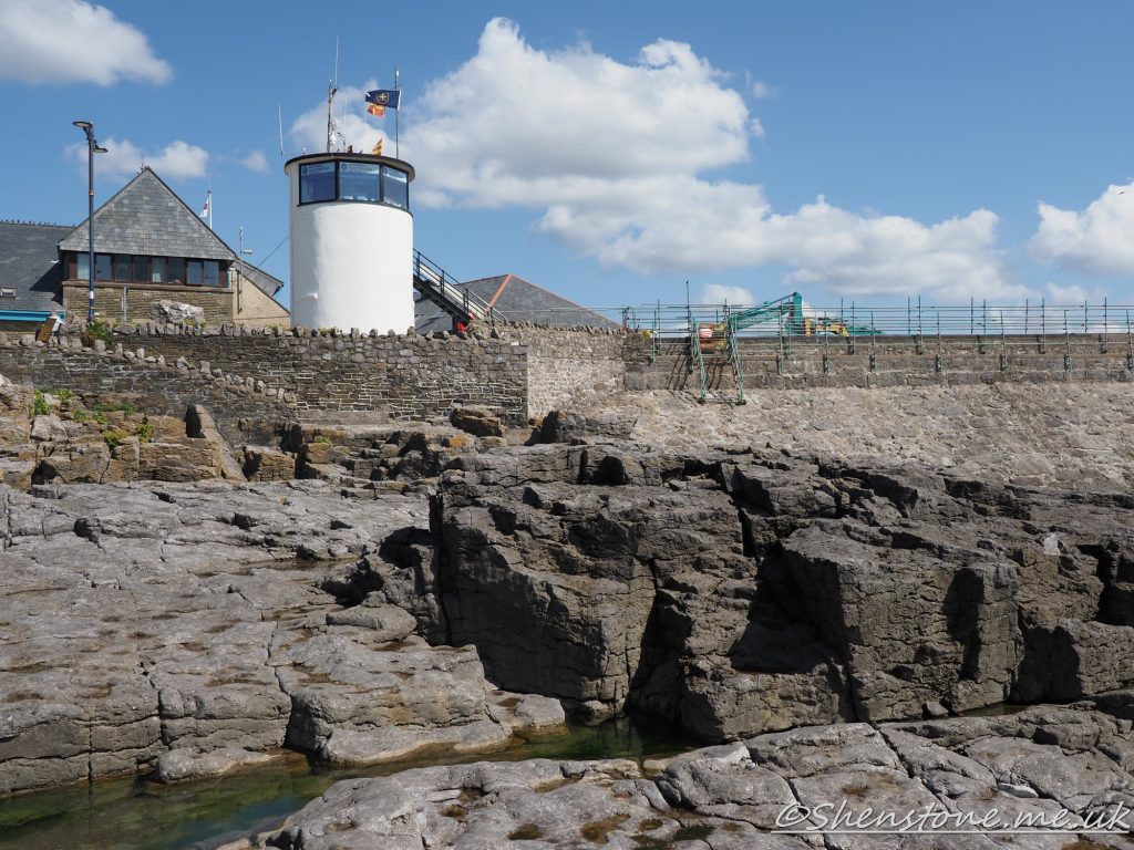
Location 1 - Yorke Rock bed View from Location 1 across to the steeply dipping Carboniferous age limestone of Cold Knap PointLooking in more detail to the right of the headland you can see the almost horizontal Jurassic aged rocks in the background At Locality 3 you can see Carboniferous aged limestone with Triassic aged breccia overlying it. This is a time gap of about 100 million years of rocks that are missing between these two rocksYou can also see the crinoid fossils in the Carboniferous aged rocksAt locality 4 you can clearly see that the Triassic aged breccia contains lumps of the Carboniferous aged limestone
We hope you enjoyed this short tour of Barry Island. If you’d like to learn more about our local geology, take a look at other pages on the South Wales Geologists’ Association website: www.swga.org.uk
This is some additional information and pictures to support the geology walk at Porthcawl. Take a look at the descriptions under each picture to see more information
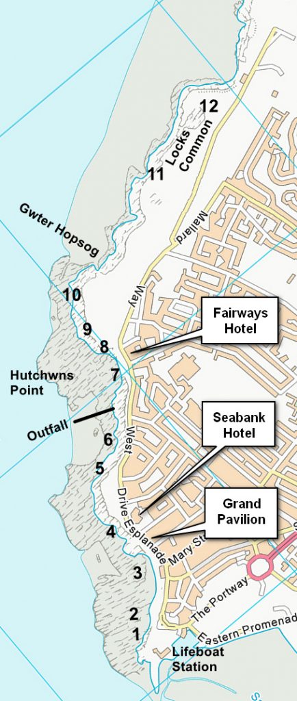
The Localities mentioned on this post relate to the map which is included in the leaflet PDF and is repeated here to make this page easier to read. For more information and descriptions of all the localities and the start point, parking etc. please see the leaflet
To download and print this walk, please open / download the PDF version here
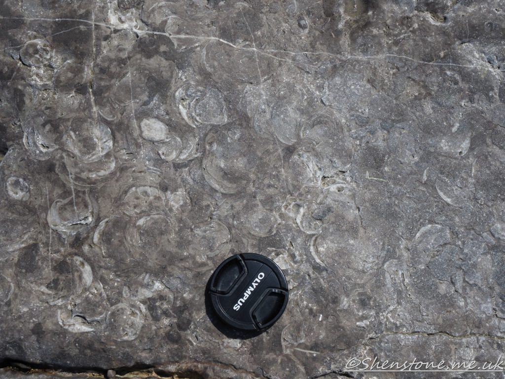
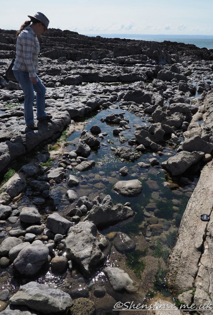
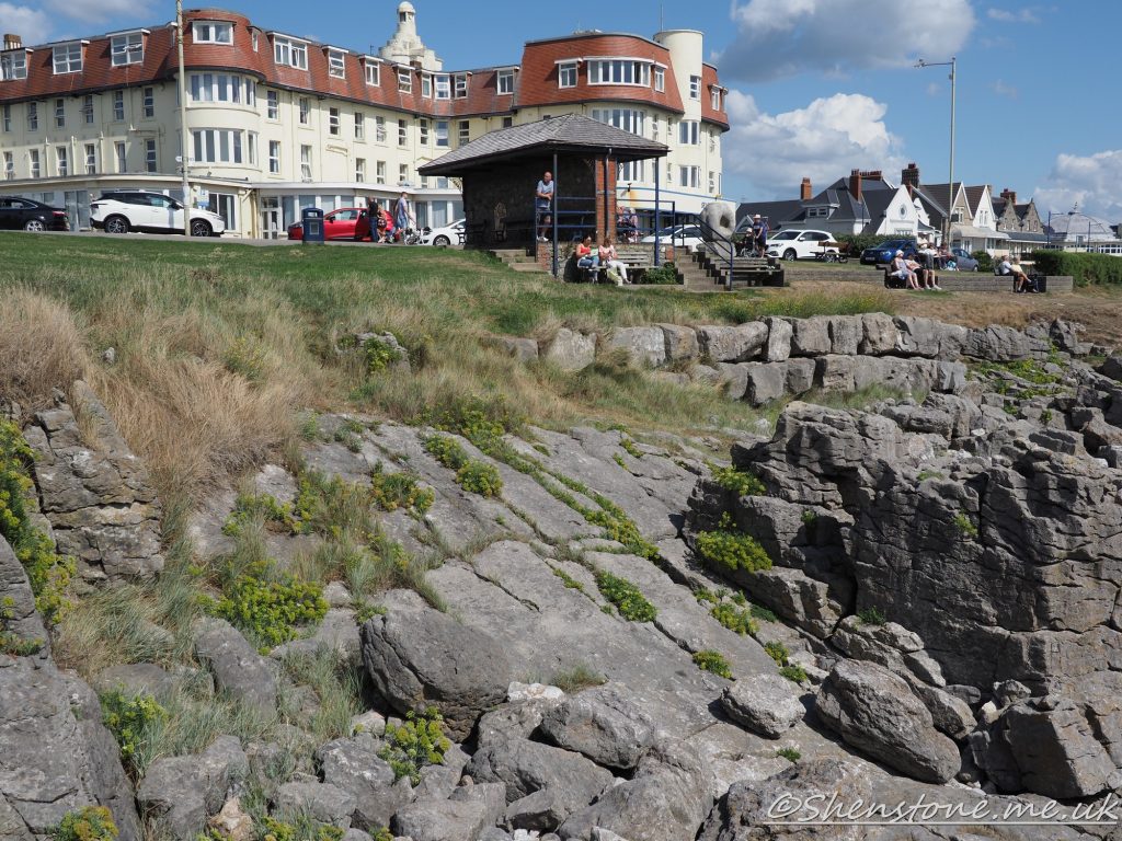
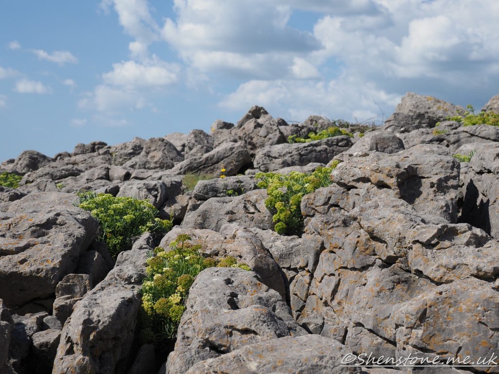
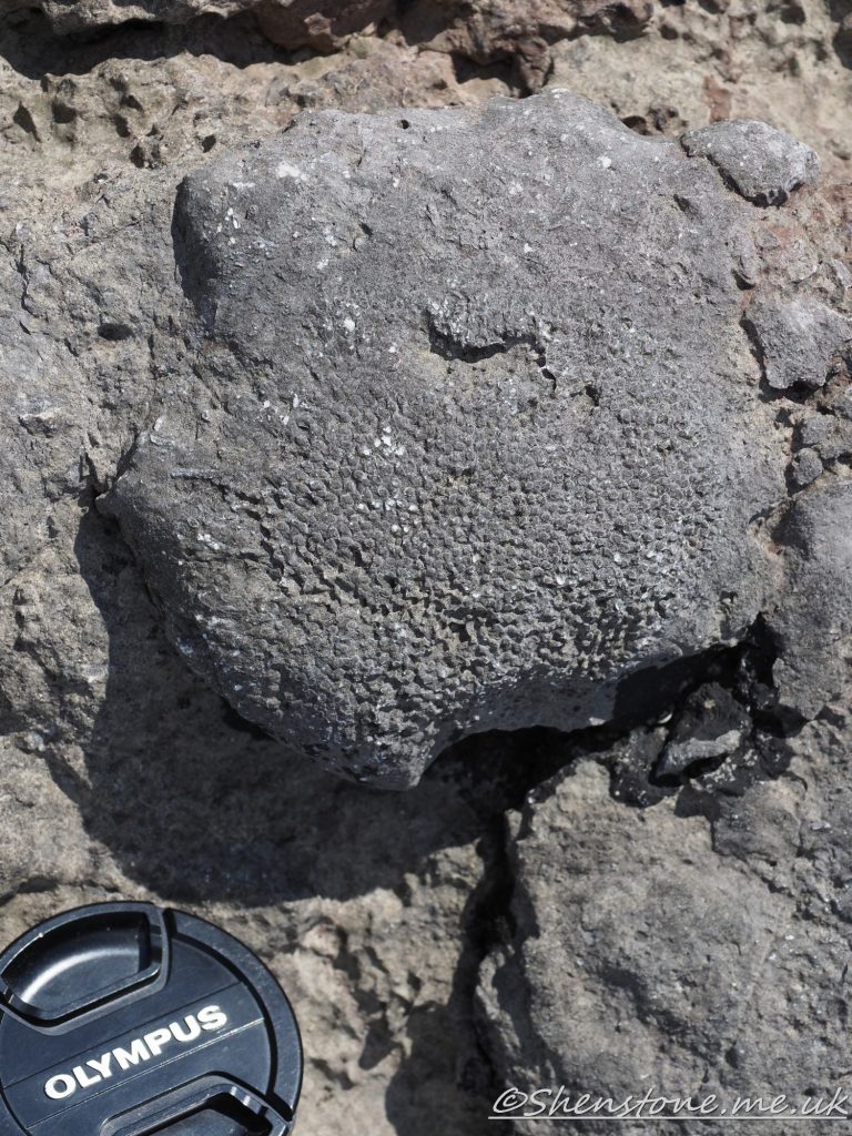
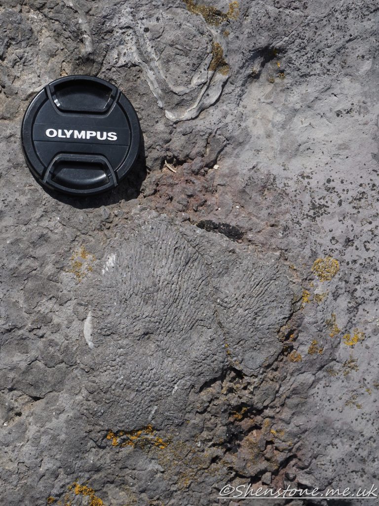
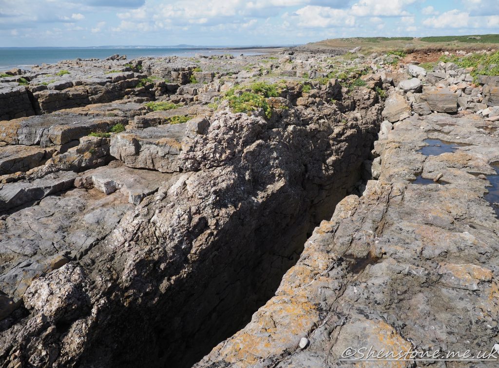
Locality 1 - Oxwich Head Limestone of carboniferous ageLocality 1 - details of the fossils these are brachiopods an ancient type of seashellLocality 2 where the small fault cuts the limestone and gives these straight lines on the beachLocality 4 the grassy area opposite the Seabank Hotel with the subarial erosion forming a limestone pavement as can be seen in more details in the picture below. The blocks are called clints and the gaps are called grykes and often get plants growing in them as they provide some shelter and often moisture at the bottom Locality 4 limestone pavement type weatheringLocality 6 - coral fossilLocality 6 coral fossilLocality 11 A deep gully eroded along a fault line
We hope you enjoyed this short tour of Porthcawl. If you’d like to learn more about our local geology, take a look at other pages on the South Wales Geologists’ Association website: www.swga.org.uk
Welcome to the Llanbadoc Geology trail, Monmouthshire. Here are on line versions of leaflets published by Ramblers Cymru available in English and Welsh , and an extended version for those who wish to know a bit more. There is also a quiz covering the whole trail but also for a shortened walk to Cefn Ila and back to Llanbadog. By Elen Wharton.
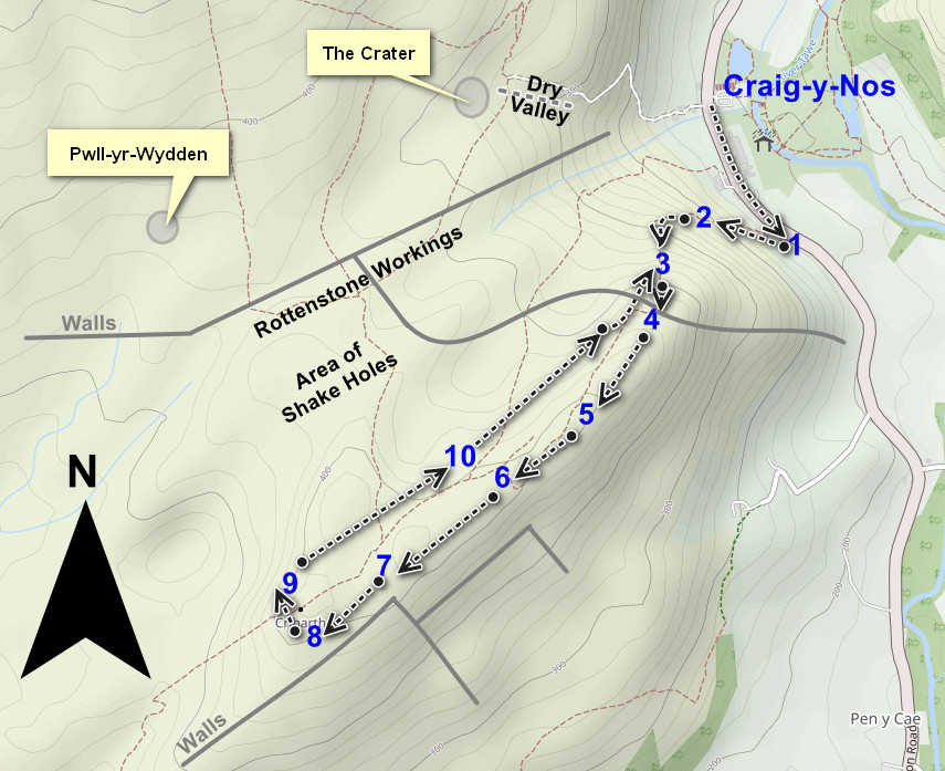
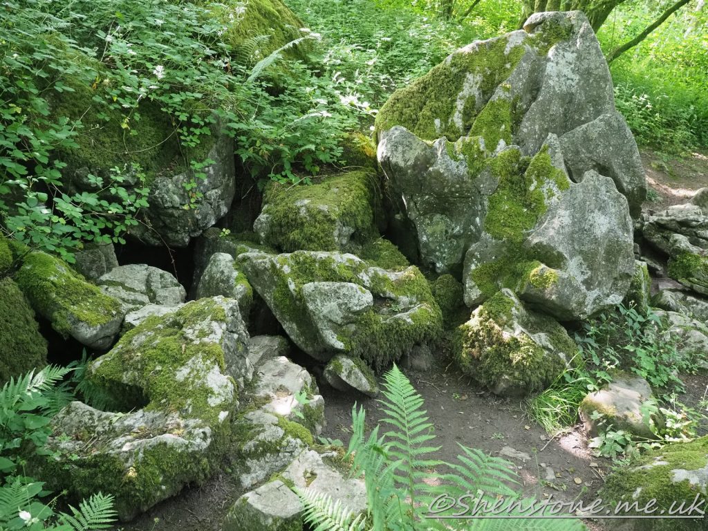
This is some additional information and pictures to support the geology walk at Cribarth from Craig-y-Nos. Take a look at the descriptions under or above each picture to see more information
The Localities mentioned on this post relate to the map which is included in the leaflet PDF and is repeated here to make this page easier to read. For more information and descriptions of all the localities and the start point, parking etc. please see the leaflet
To download and print the leaflet version of this walk, please open / download the PDF version here
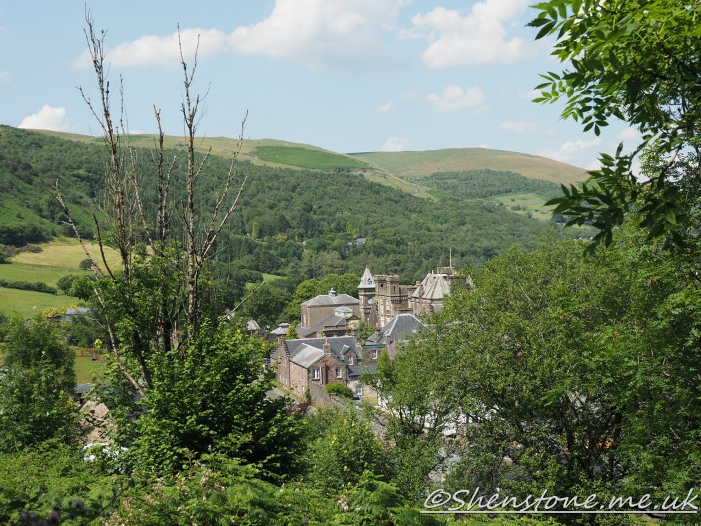
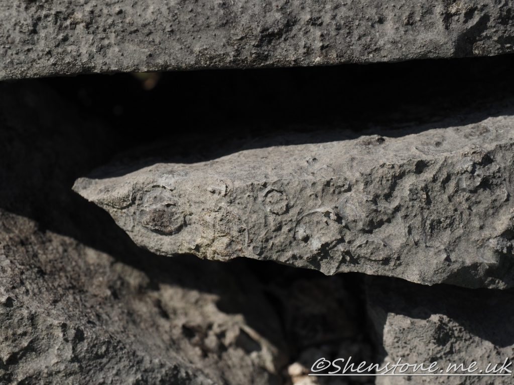
The view north from above Locality 1 looking over Craig y Nos castle towards the Old Red Sandstone of the beaconsFossils in the wall at Locality 3
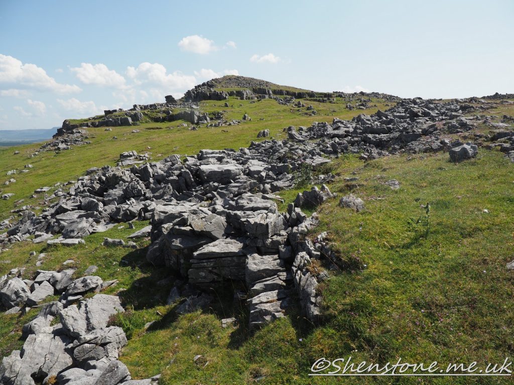
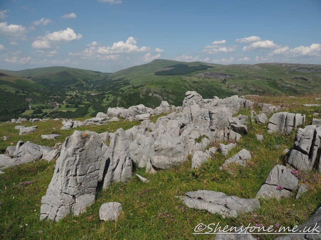
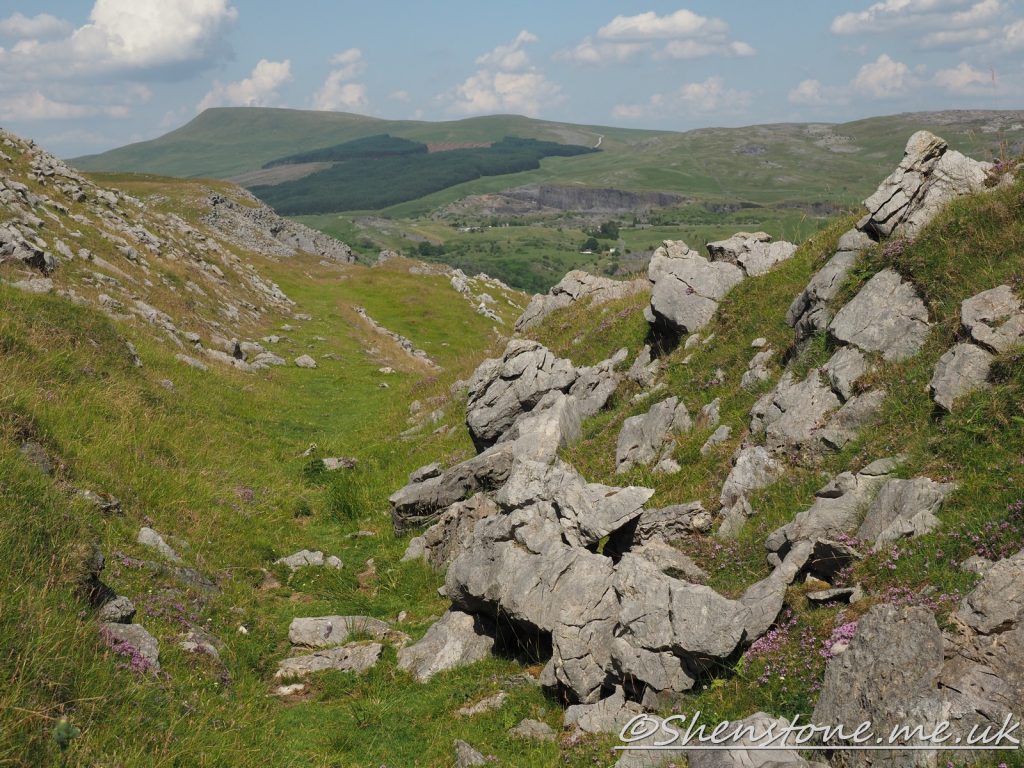
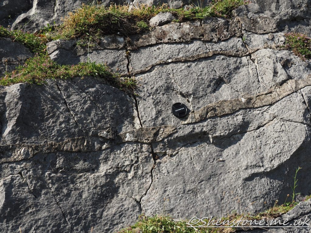
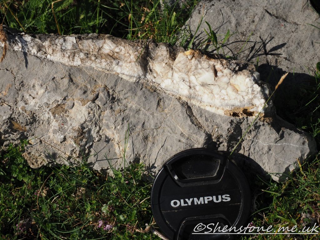
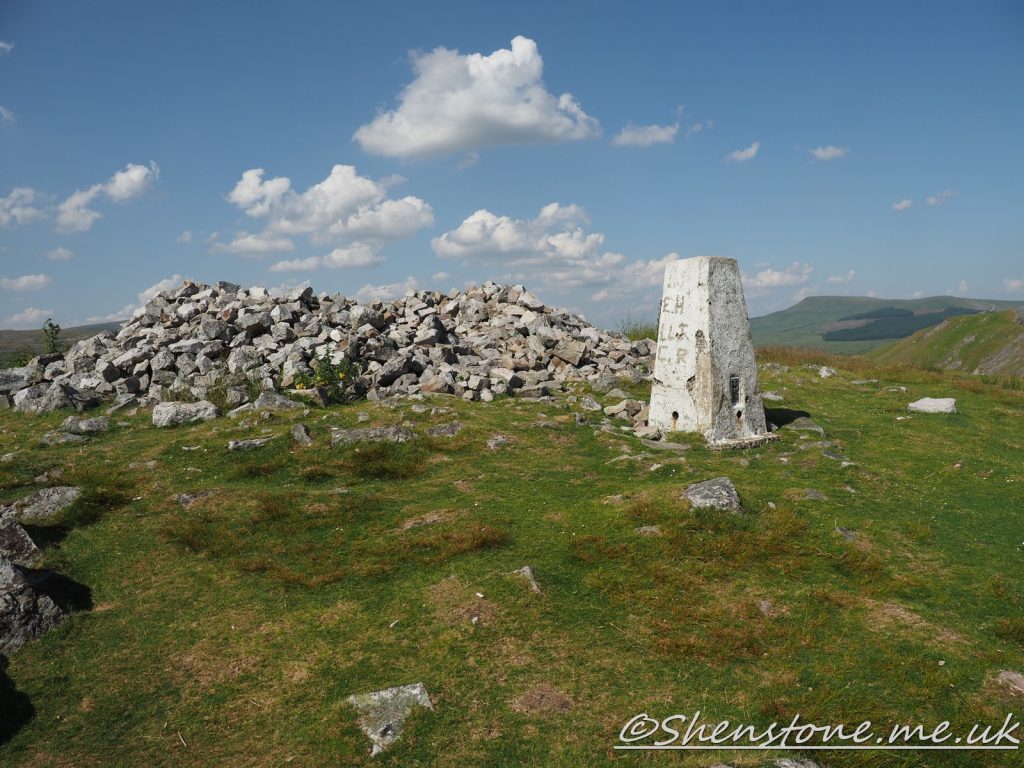
Above and below - the area of limestone pavement at Locality 4The old tramroad at Locality 5 with the outcrop on the right hand side as seen in this picture (looking back to Locality 4. it will be on your left (the south eastern side) as you walk the trail. A close up of the Honycombe sandstone can be seen below Nodules of chert (just below the lens cap showing the scale of the picture) above and a vein of calcite crystals in the picture below - both are at Locality 7 Quartzite blocks at the triangulation point (Locality 8) have been used in ancient times to construct a cairn or shelter. These probably came from the crags at Locality 9 just to the north of this point
We hope you enjoyed this short tour of Cribarth from Craig-y-Nos. If you’d like to learn more about our local geology, take a look at other pages on the South Wales Geologists’ Association website: www.swga.org.uk
This is some additional information and pictures to support the geology walk at Ogmore-by-Sea. Take a look at the descriptions under each picture to see more information
The Localities mentioned on this post relate to the map which is included in the leaflet PDF and is repeated here to make this page easier to read. For more information and descriptions of all the localities and the start point, parking etc. please see the leaflet
To download and print this walk, please open / download the PDF version here
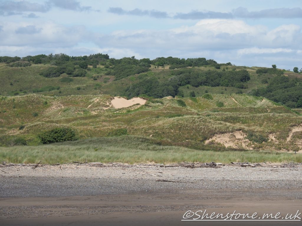
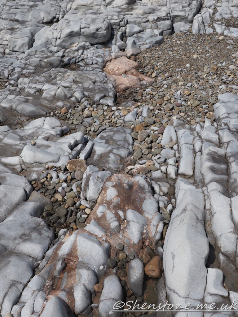
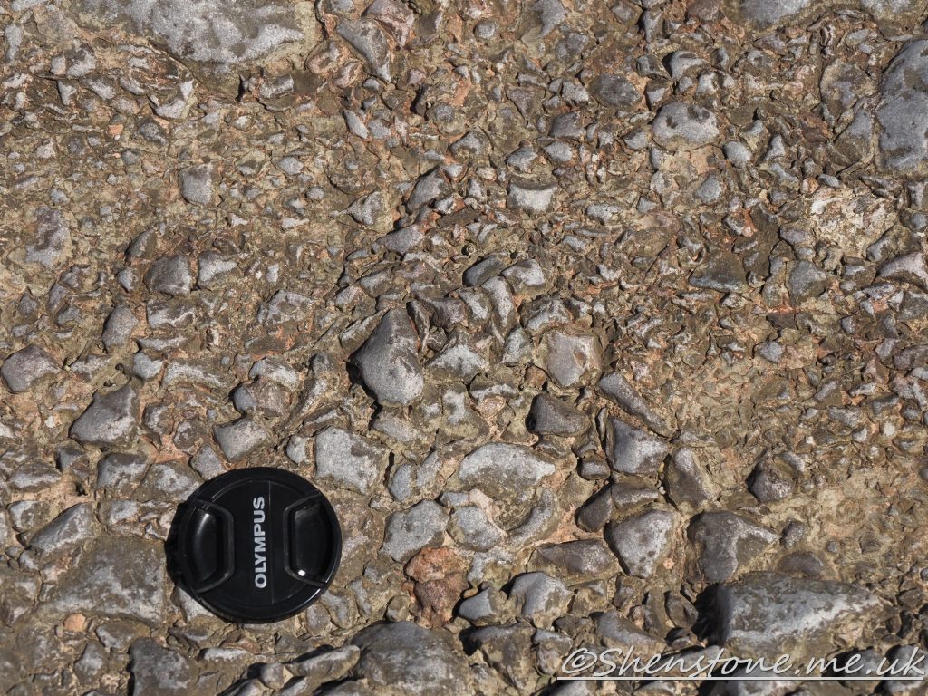
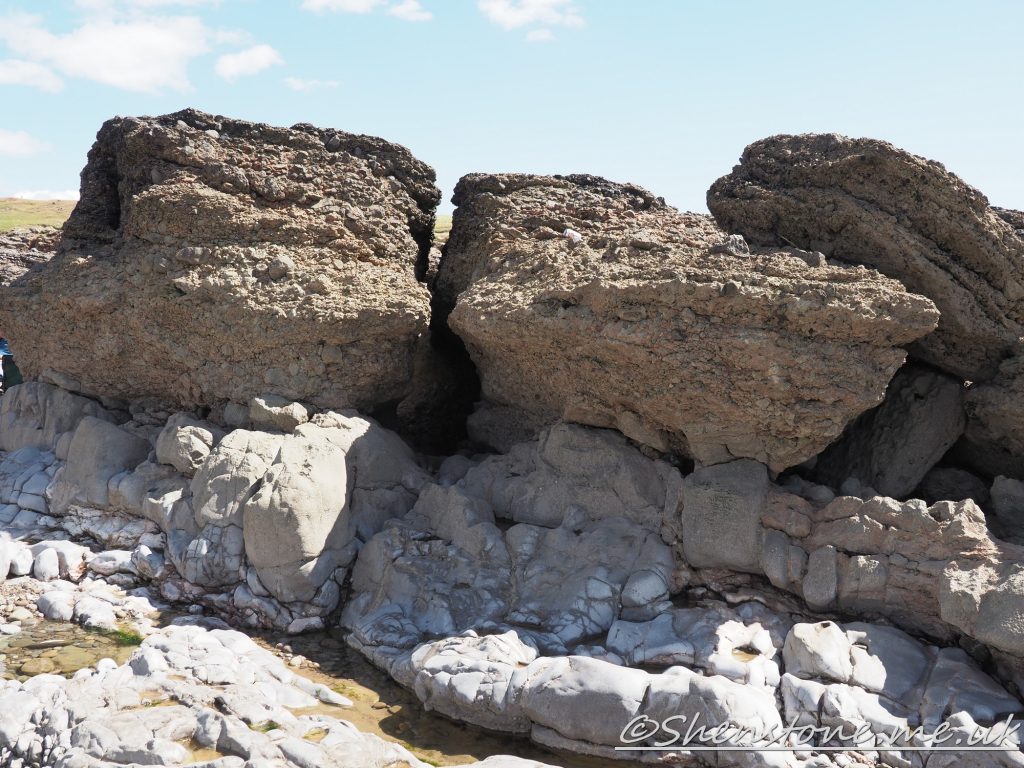
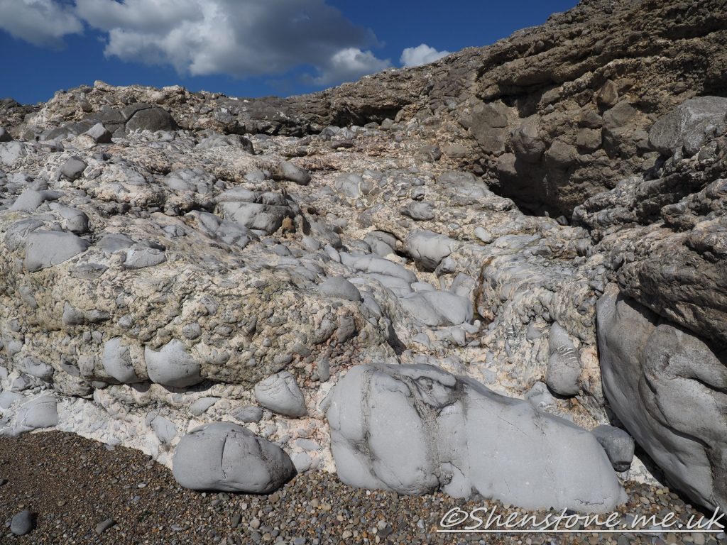
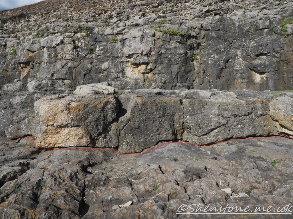
The view over the sand dunes of Merthyr mawr from Locality 1 these are as recent as the 16th centuryThe pink colured sandstone and conglomerate of Triassic age filling in the fissures in the Carboniferous aged limestone. The grey blocks within the pink are blocks of the older rocks that have been washed into the fissures along with the "younger" sandsAngular fragments of limestone in the Triassic Breccia showing the limited weathering that has taken place indicating a low movement from their source location Obvious unconfirmity between the Carboniferous aged Limestone below and the Triassic aged conglomerate aboveCaninia The more rounded clasts and less pink coloured breccia at Locality 7 indicating more traansport weathering than at the previous locality. The junction between the Carboniferous aged limestone and the Sutton Stone (above the red line) at Locality 8
We hope you enjoyed this short tour of Ogmore-by-Sea, Vale of Glamorgan. If you’d like to learn more about our local geology, take a look at other pages on the South Wales Geologists’ Association website: www.swga.org.uk
This is some additional information and pictures to support the geology walk at Pontneddfechan. Take a look at the descriptions under each picture to see more information
The Localities mentioned on this post relate to the map which is included in the leaflet PDF and is repeated here to make this page easier to read. For more information and descriptions of all the localities and the start point, parking etc. please see the leaflet
To download and print this walk, please open / download the PDF version here
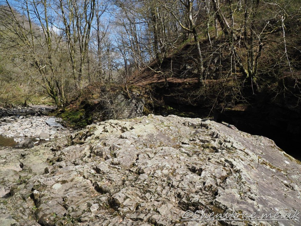
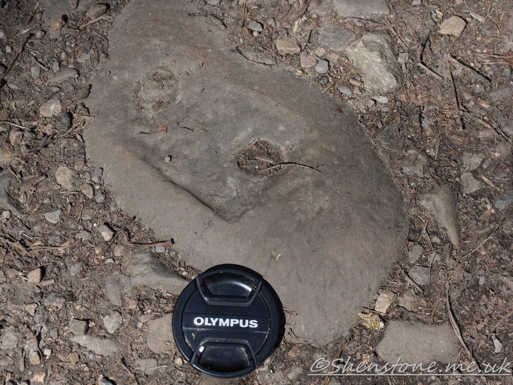
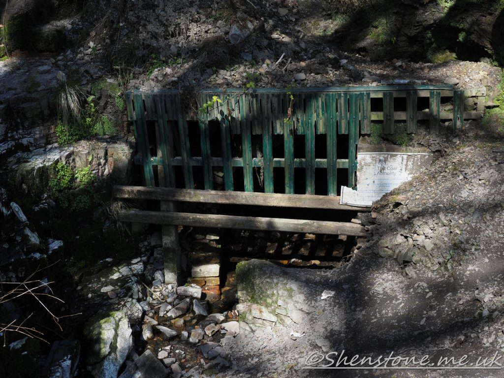
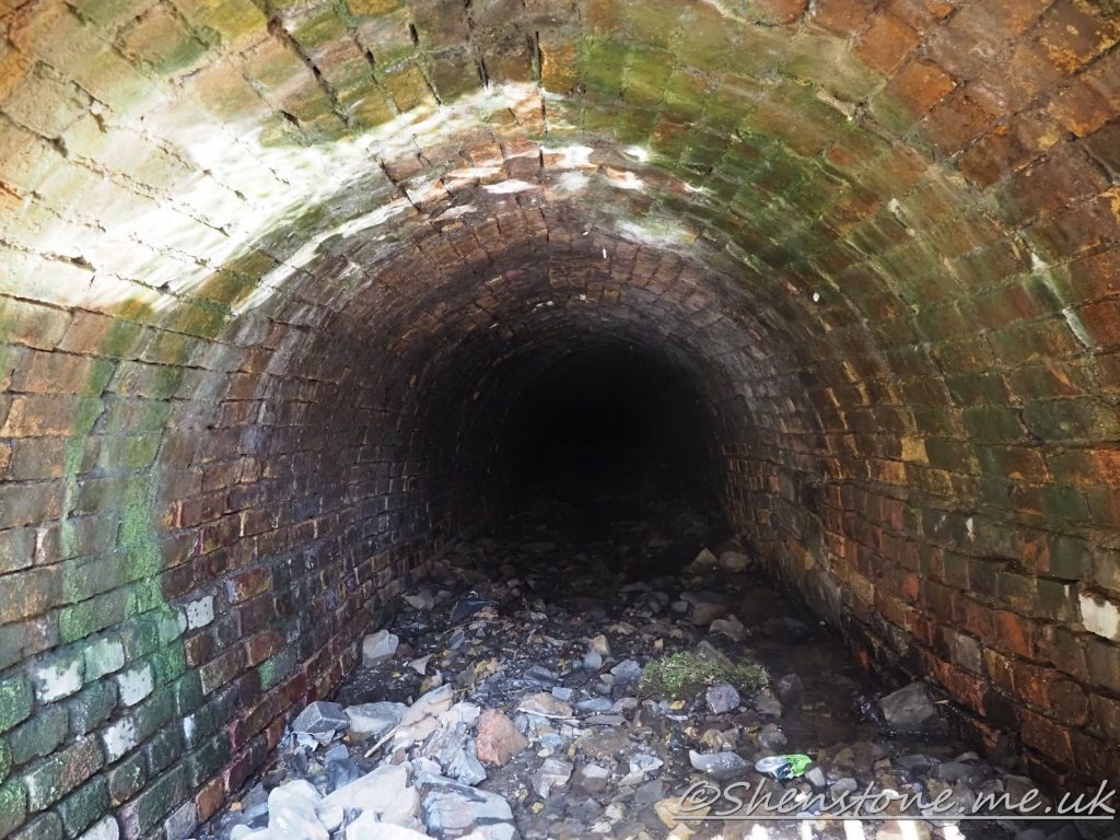
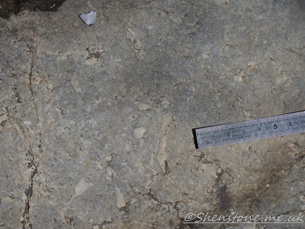
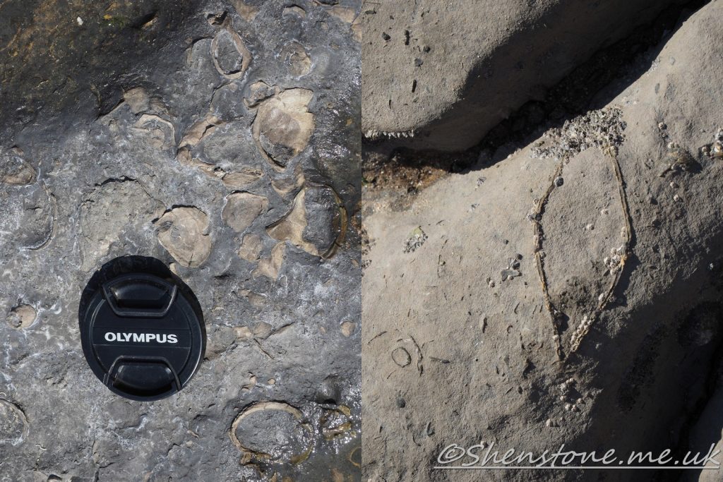
The Quartzite Bed in the Bishopston Mudstone Formation at Locality 3A block that has been drilled and as used as a sleeper to hold the railway tracks on an old small mining railway that once used the valley floor as a track The lenscap is to show the scale (its about 75mm across) putting an object in a picture to give scale is something that geologists do so that they can measure things later if neededFossil bivalve Carbonicola at Locality 4. These are small and not easy to spot as you can tell from the scale. They would break up if collected so you are much better to take a picture and leave them for other people to see when they visitAn entrance to old mine workings at Locality 7. IT IS NOT SAFE TO ENTER!However if you look through with a torch or take a picture you can seen the wonderfully crafted brickwork that makes up this tunnel. This tunnel is too small for regular use by people and was probably a drainage tunnelThe top of the Twrch Sandstone Formation described at Locality 9The fossil roots described at Locality 12
We hope you enjoyed this short tour at Pontneddfechan. If you’d like to learn more about our local geology, take a look at other pages on the South Wales Geologists’ Association website: www.swga.org.uk
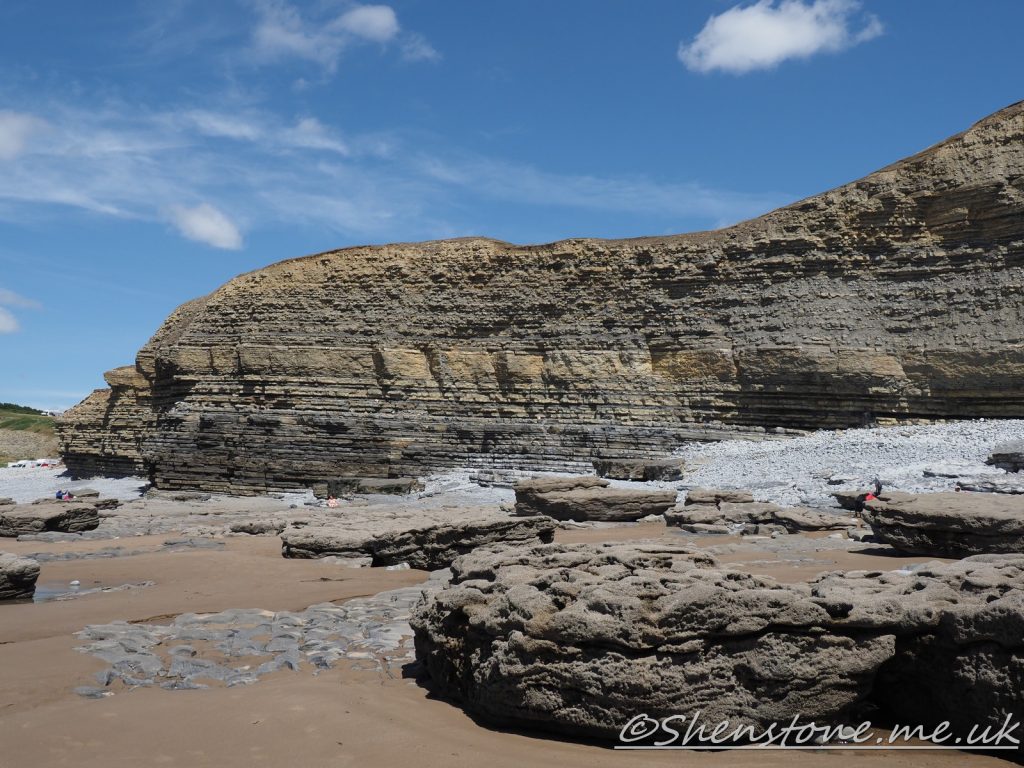
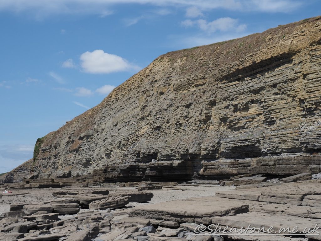
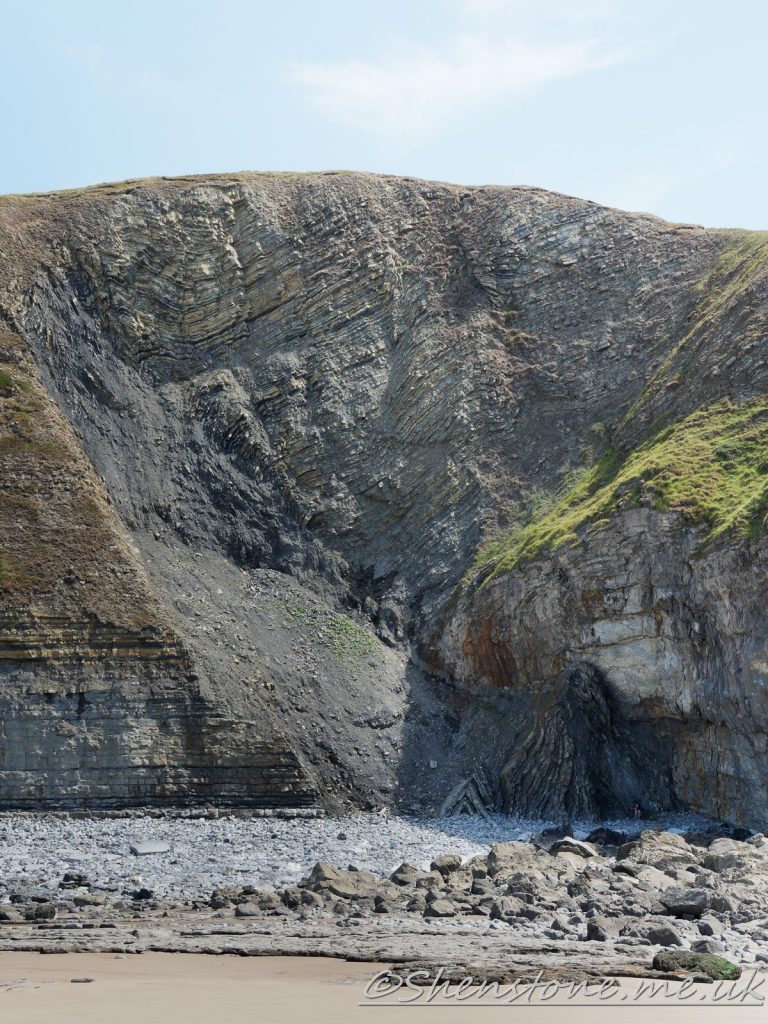
This is some additional information and pictures to support the geology walk at Southerndown, Dunraven Bay. Take a look at the descriptions under each picture to see more information
The Localities mentioned on this post relate to the map which is included in the leaflet PDF and is repeated here to make this page easier to read. For more information and descriptions of all the localities and the start point, parking etc. please see the leaflet
To download and print this walk, please open / download the PDF version here
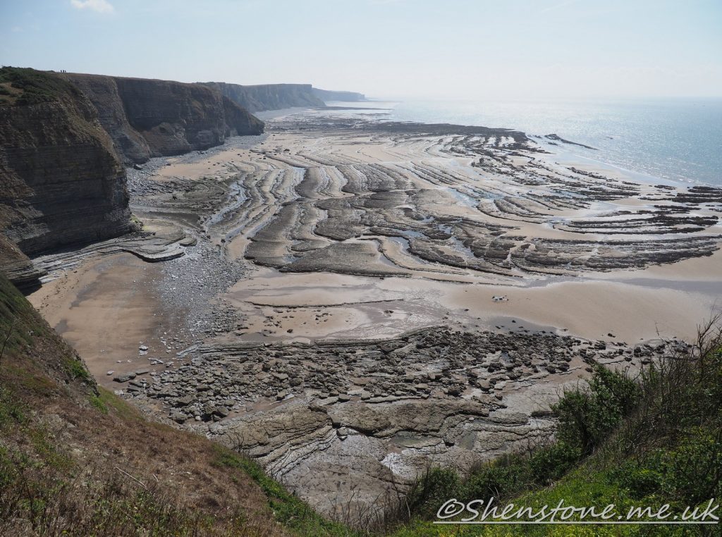
The thick bed of rock described at location 3 is clearly seen further west in the cliffTo the west of the car park. These cliffs look spectacular, but they are also dangerous and it's not a good idea to sunbathe at the foot of the cliffs. There have been fairly recent deaths by falling rocks on this coastlineStanding well back is also sensible on the eastern side and here looking at Location 4 with this wider angle view than the one in the leaflet, you can clearly see how the fault planes are not just in the lower corner, but are visible in the full height of the cliffYou can see that the rocks at the bottom are horizontal, whereas the ones above dip to the right of this picture. The Carboniferous rocks at the bottom of the cliff have been eroded and then at a much later time the jurassic rocks have been deposited on top of them. This time gap is called an unconformity. There is no way for geologists to know what happened in this location in that missing time record but by looking at other places where these rocks were not worn away they can infer a larger scale view of that missing timeA geologist standing well back and admiring the anticline (upwards fold) in the jurassic rocks at locality 9Oysters (left) and Pinna (right) on the rocks of Southerndown beach foreshore View of the Structures (folding and faulting) on the beach looking from Location 12 in the walk towards Nash Point
We hope you enjoyed this short tour of Dunraven Bay. If you’d like to learn more about our local geology, take a look at other pages on the South Wales Geologists’ Association website: www.swga.org.uk
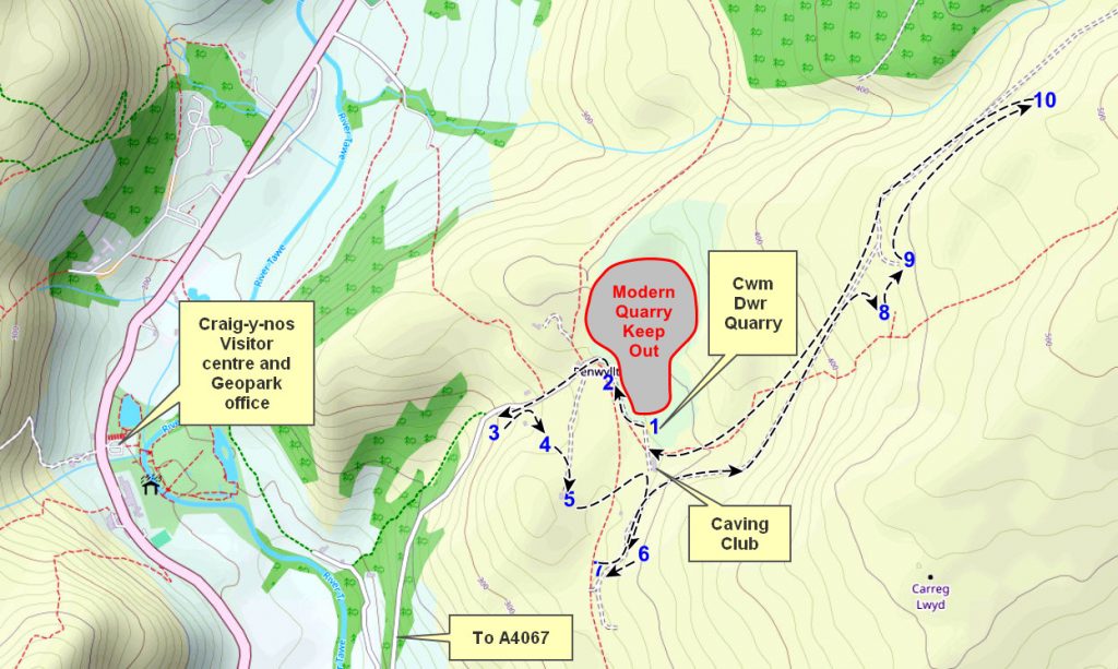
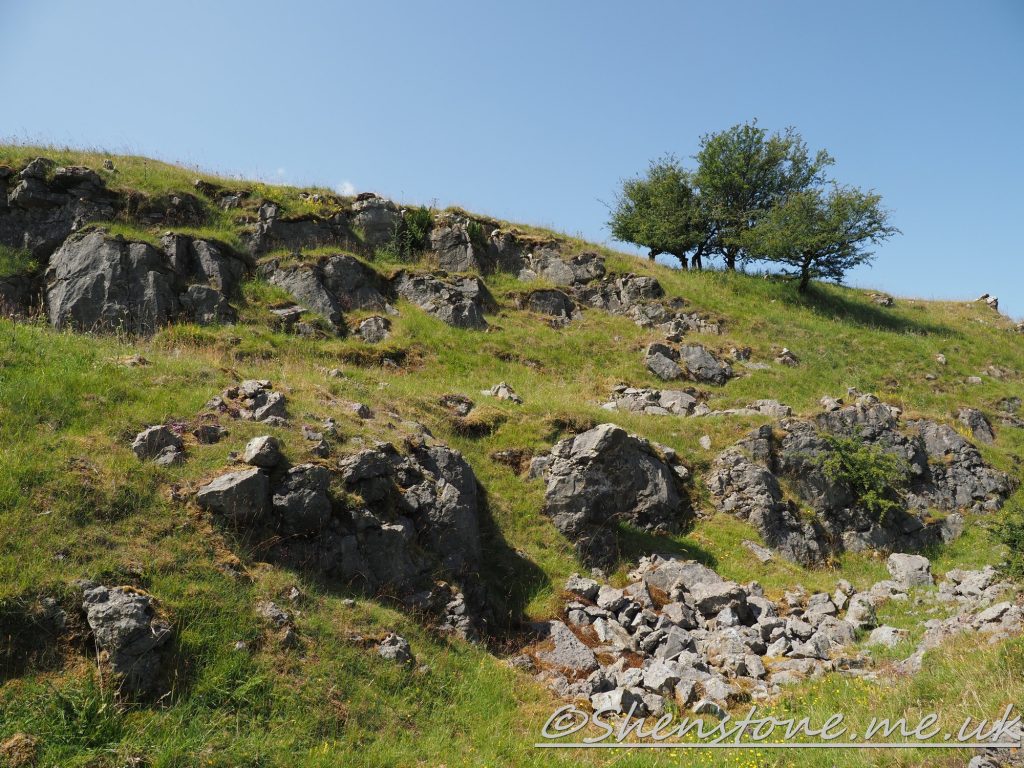
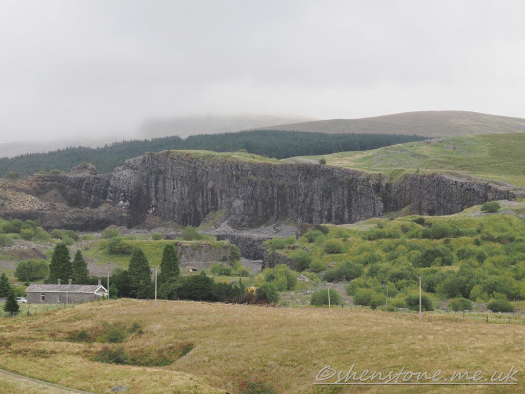
This is some additional information and pictures to support the geology walk at Penwyllt and the Ogof Ffynnon Ddu Nature Reserve. Take a look at the descriptions under each picture to see more information
The Localities mentioned on this post relate to the map which is included in the leaflet PDF and is repeated here to make this page easier to read. For more information and descriptions of all the localities and the start point, parking etc. please see the leaflet
To download and print this walk, please open / download the PDF version here
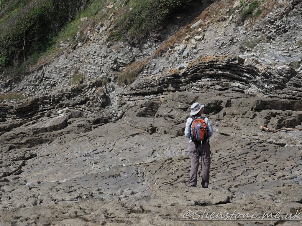
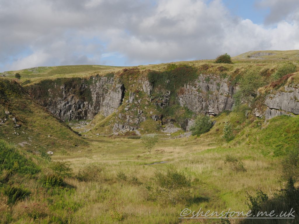
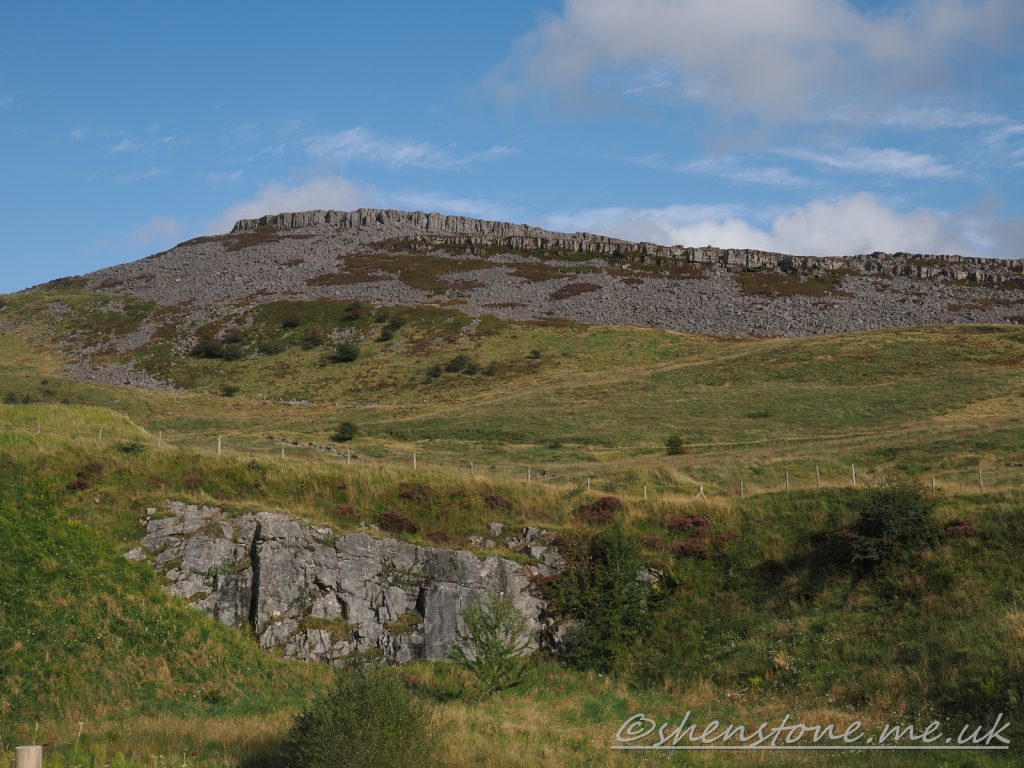
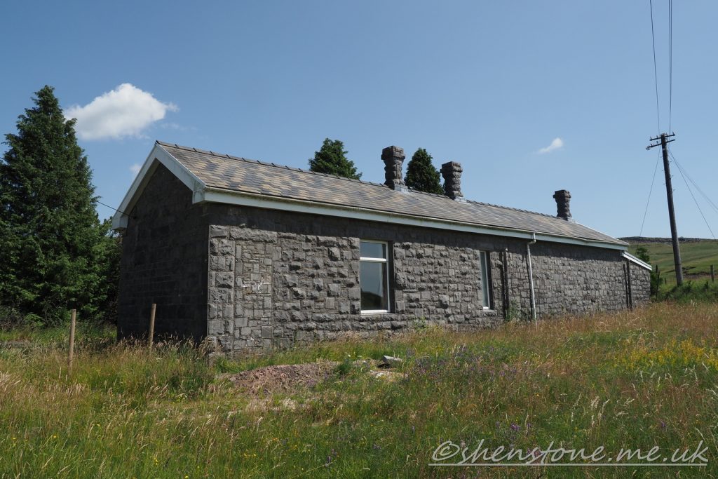
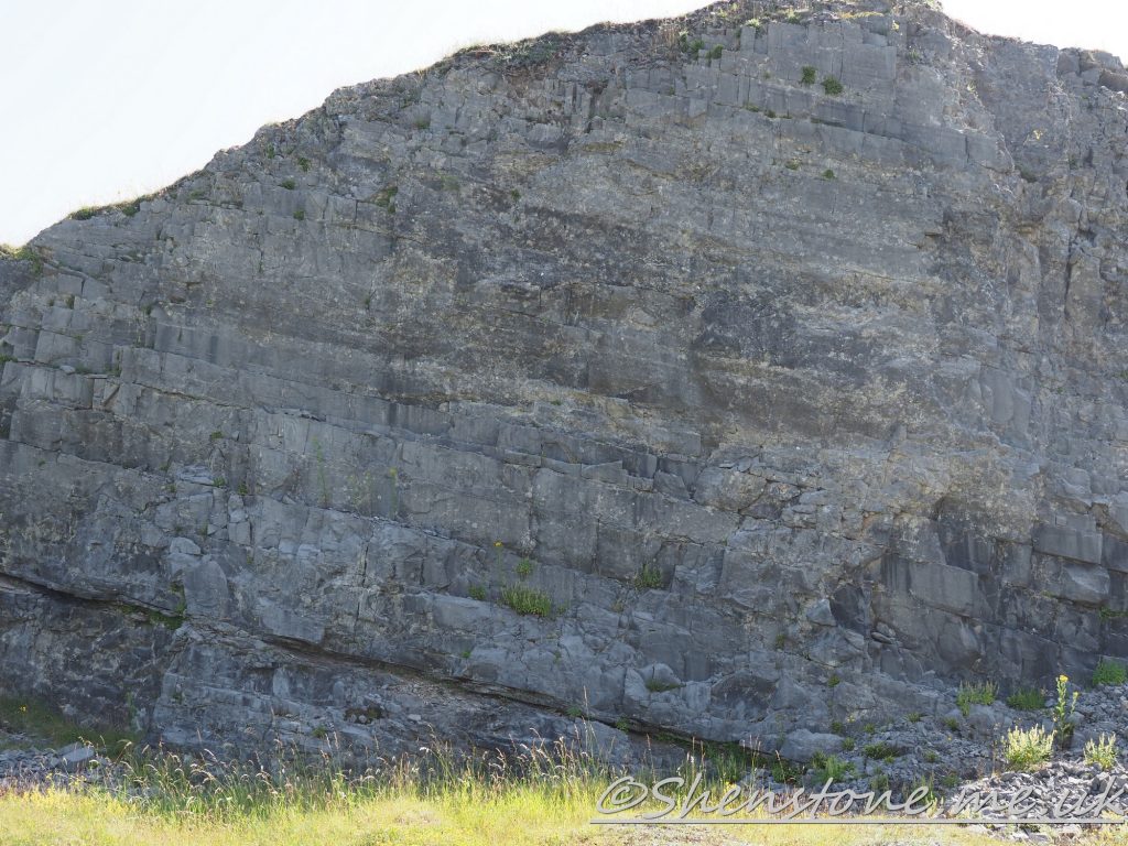
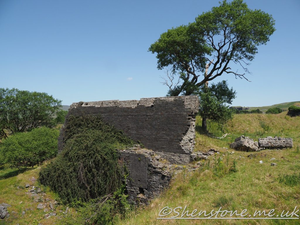
Cwm Dwr Quarry, the walk starts in the car park here and you first start with a view of the cave entrances in this old Quarry (Locality 1) , be careful near quarry facesView across Cwm Dwr Quarry to the Twrch Sandstone ridge beyond at the Car parkCraig-y-nos Station at Locality 2 on the walkSouth is to the right of this picture of the quarry face at Locality 3 The limestone dips in this direction. Overview of the crags at Locality 4From Locality 4 you have a view past Craig-y-nos station into the Modern Quarry. Although now also disused this quarry is not open for visits and should only be viewed from this hillside as an appropriate vantage pointThe chert in the limestone at Locality 6The wall of Penwyllt Bricks at the old Brickyard (Locality 7) should not be disturned or climbed onAt the old brick Kilns at Locality 7 you can find the glassy surfaces where the inside of the kilns melted
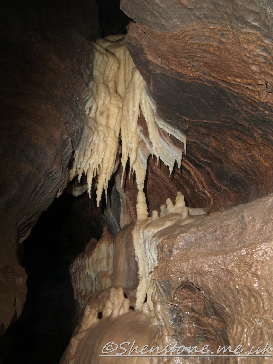
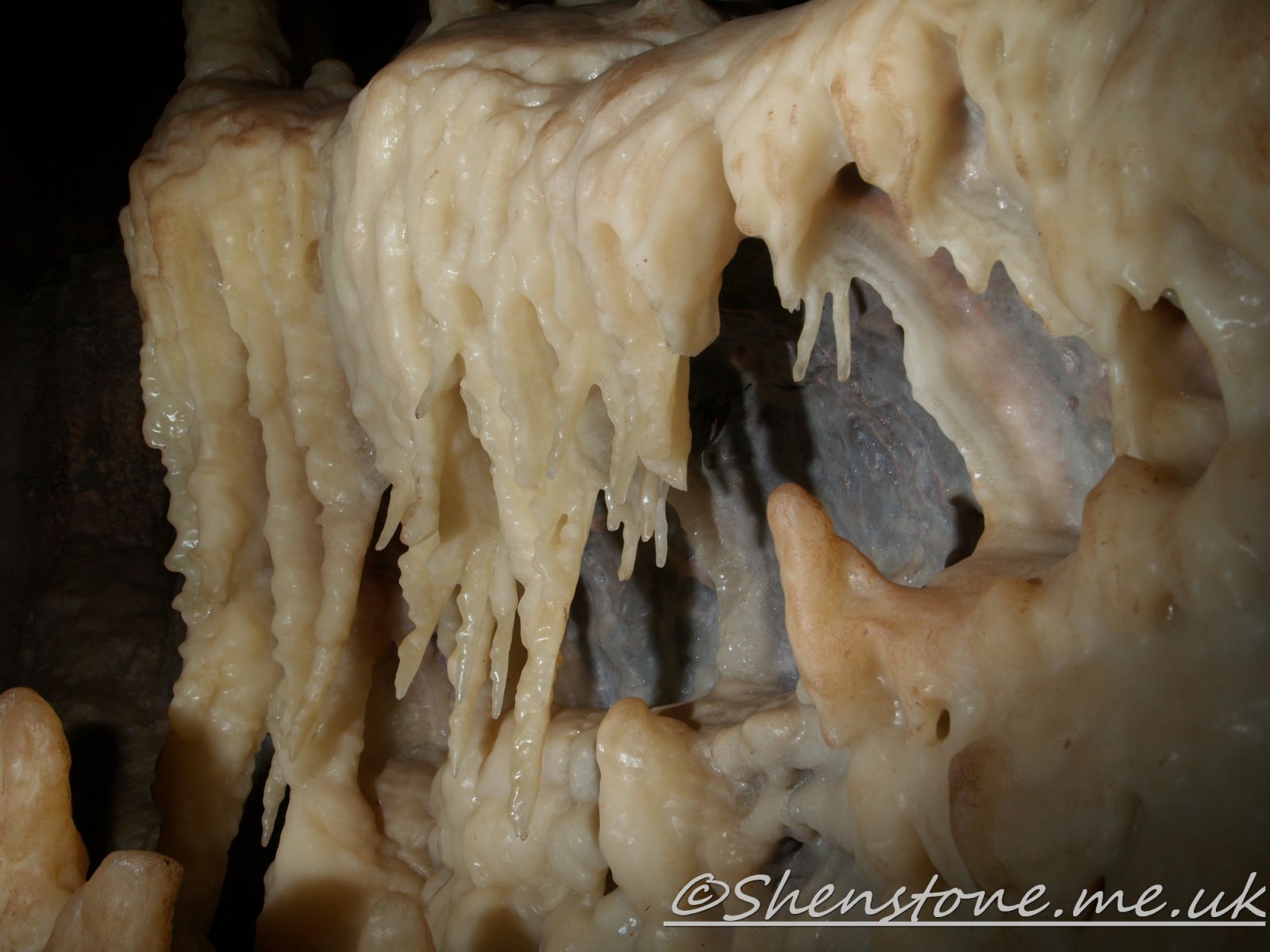
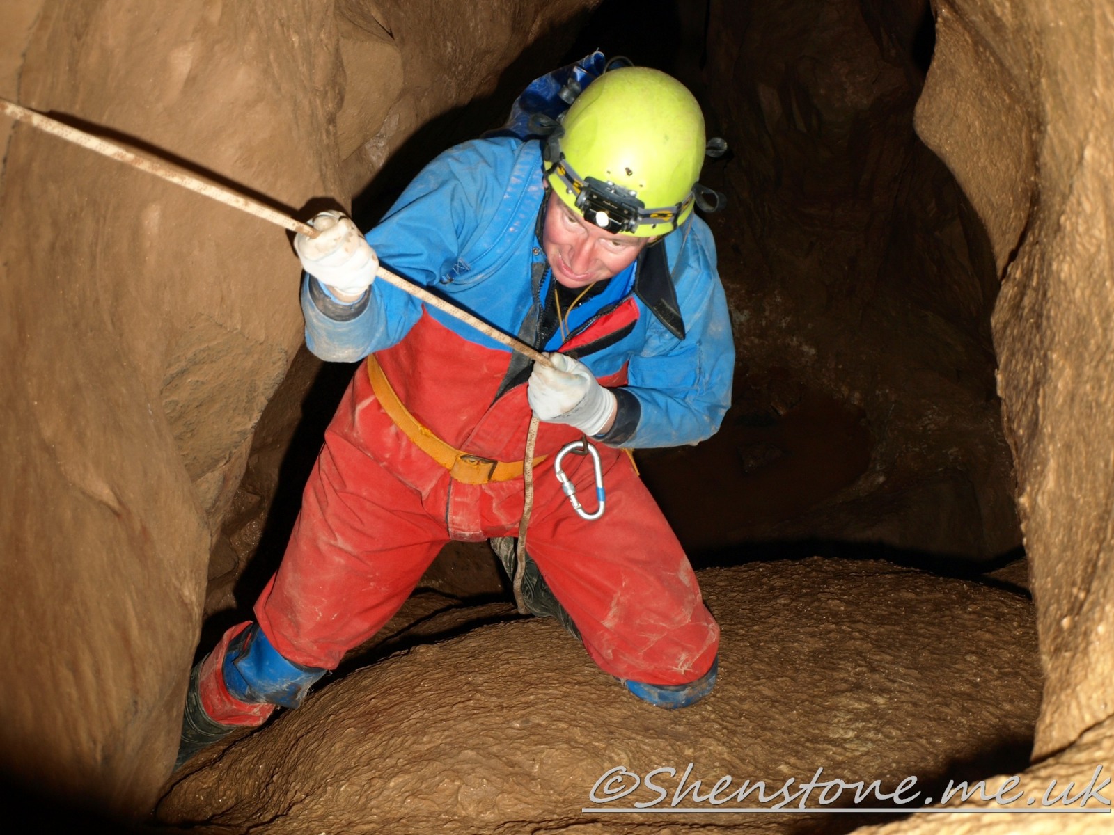
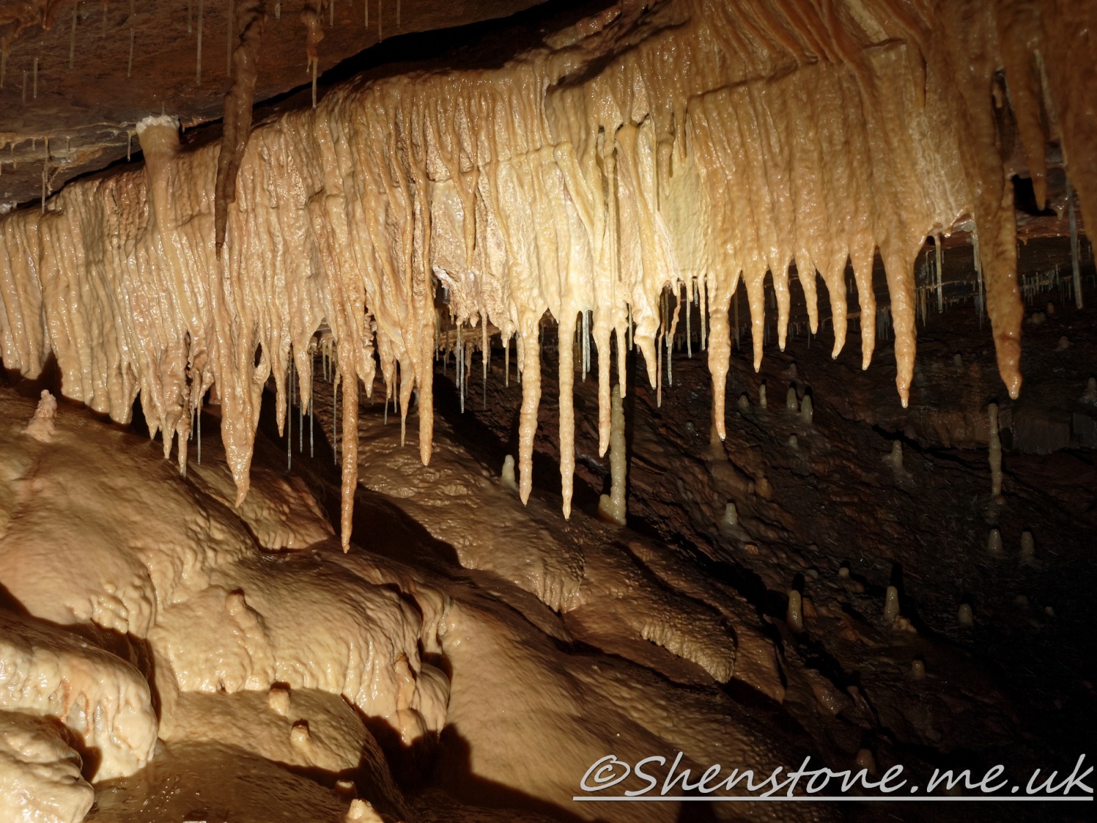
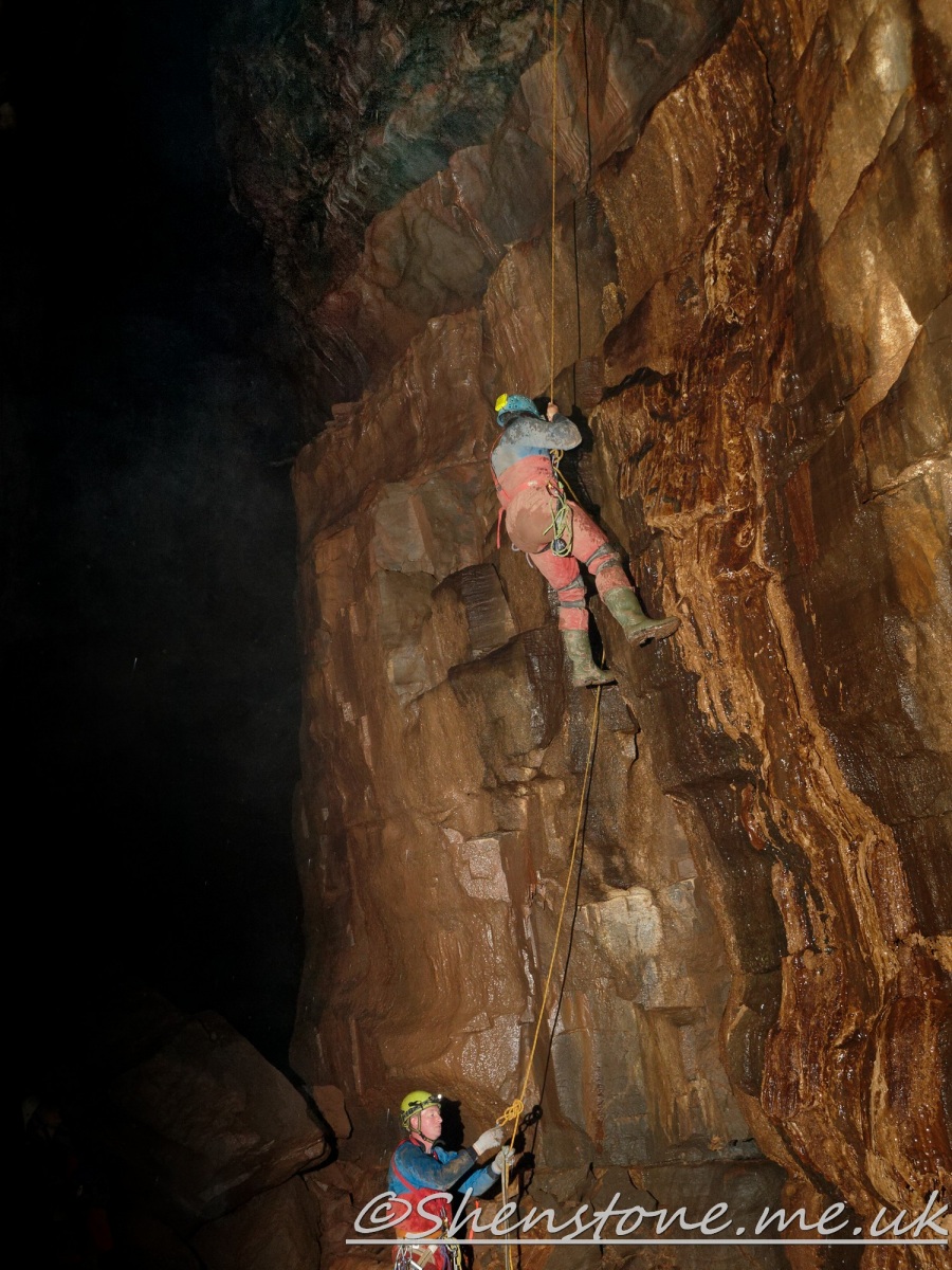
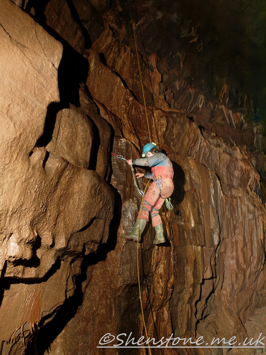
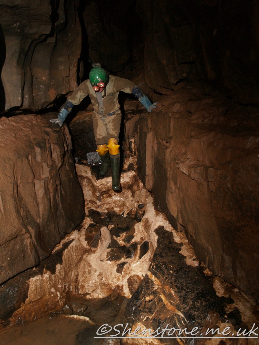
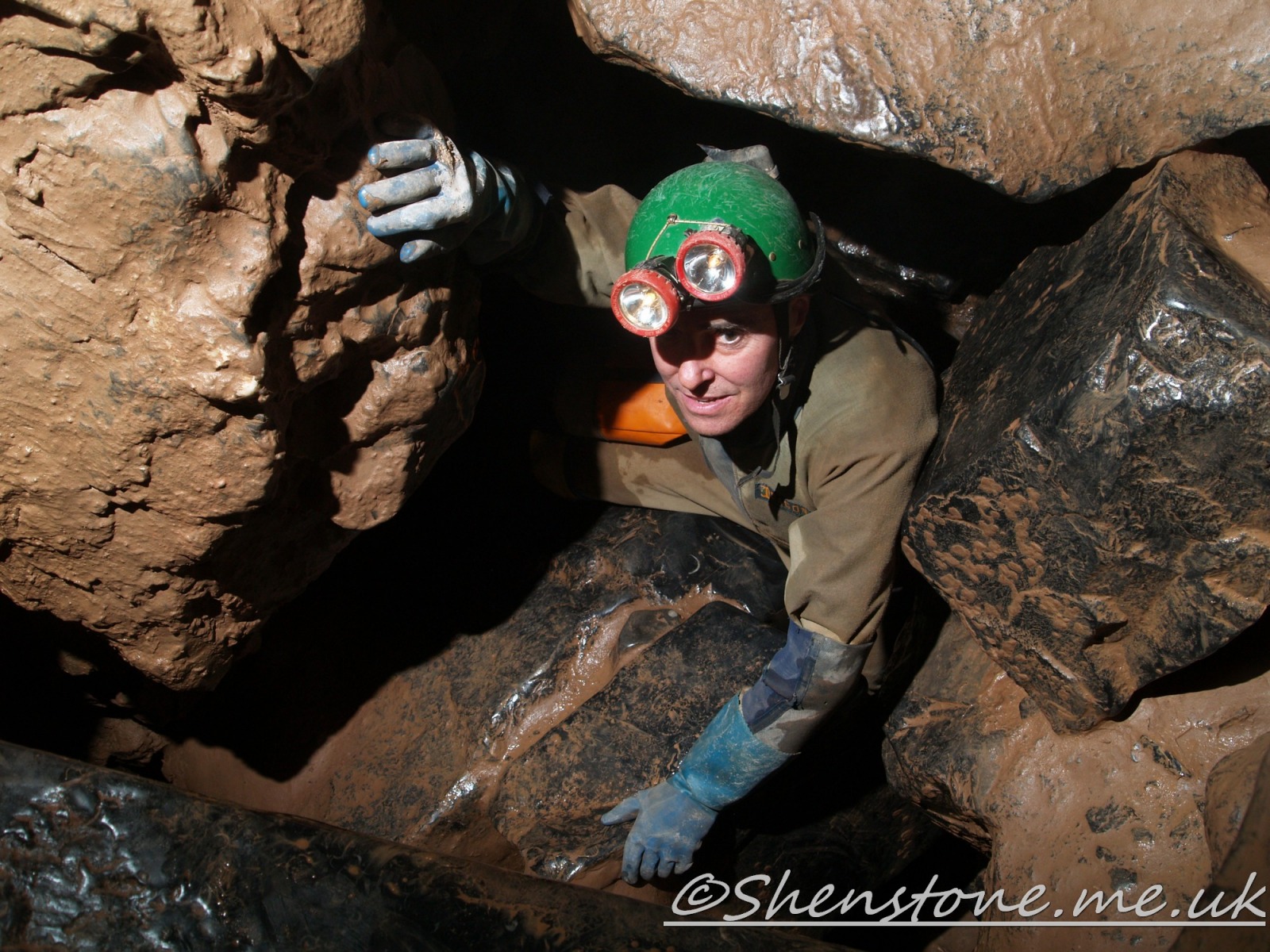
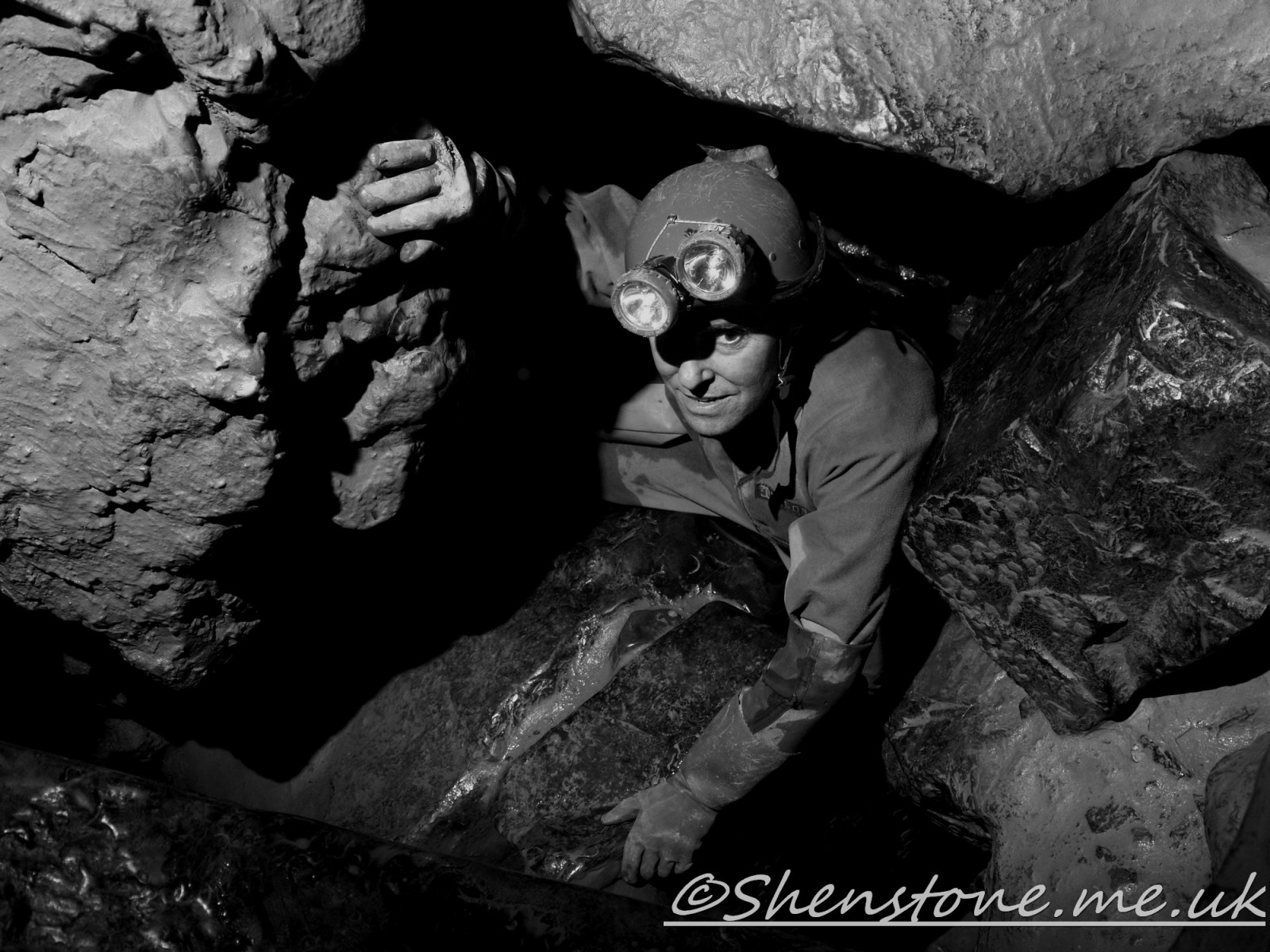
Below is a slideshow of pictures of the cave passages inside the "Top Entrance" of the cave seen at Locality 8
Click on the images to se elarger versions or manually drive the slideshow or just let it run
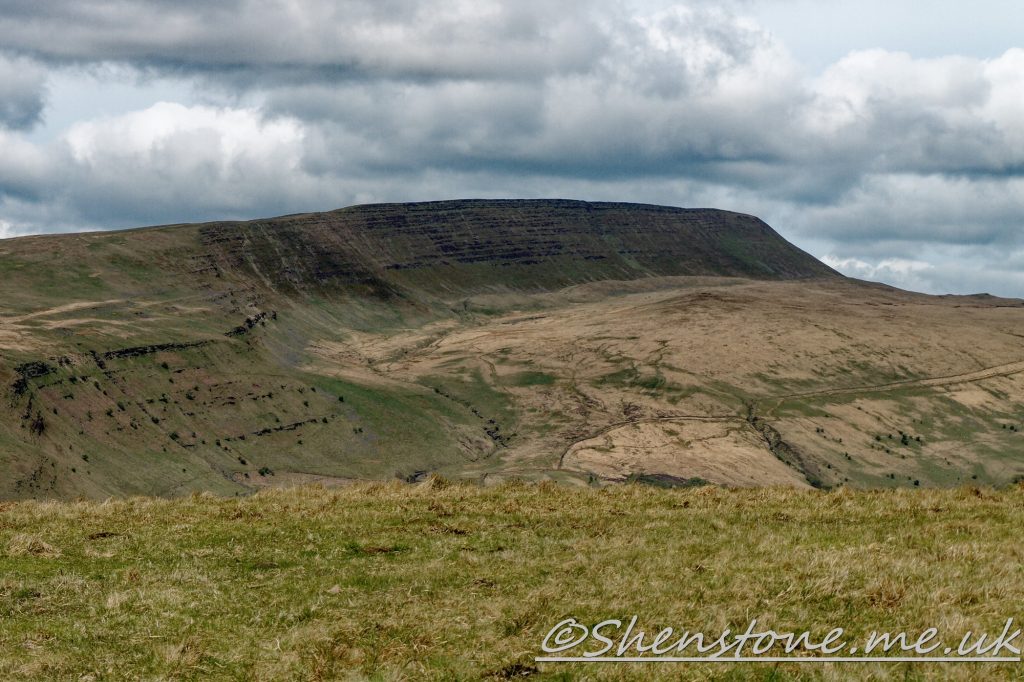
The view across the valley from Locality 10 to Fan Hir with the glacial morraines at the foot of the escarpment
We hope you enjoyed this short tour of Penwyllt and Ogof Ffynnon Ddu. If you’d like to learn more about our local geology, take a look at other pages on the South Wales Geologists’ Association website: www.swga.org.uk
This is some additional information and pictures to support the geology walk from Porth yr Ogof to Sgwd Clungwyn, Ystradfellte, Powys. Take a look at the descriptions under each picture to see more information
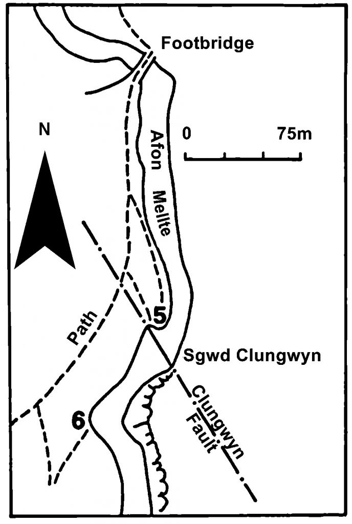
The Localities mentioned on this post relate to the map which is included in the leaflet PDF and is repeated here to make this page easier to read. For more information and descriptions of all the localities and the start point, parking etc. please see the leaflet
To download and print this walk, please open / download the PDF version here
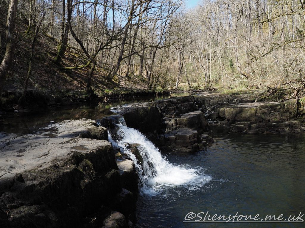
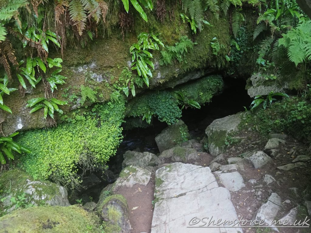
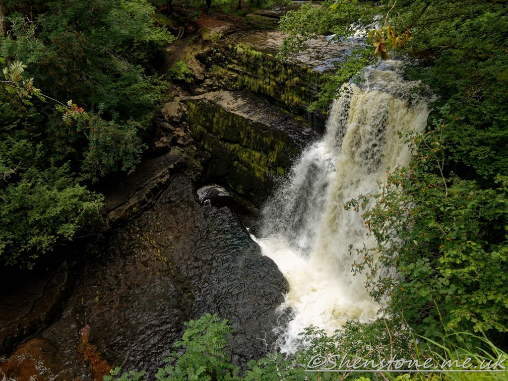
The Tradesman's Entrance to the Porth-yr-Ogof cave system at Locality 2. This leads to a dangerous part of the cave and should not be entered even under low water conditions!Caving entrances to the Porth-yr-Ogof cave system on the way to Locality 3. These lead to deep shafts and are ddangerous. These should not be entered without the correct equipment and training!The water at the Porth-yr-Ogof resurgence (Locality 4) may look inviting, but is deep, cold and dangerous and should not be entered!Scwd Clungwyn at the viewpoint descrbed at the end of the description at Locality 5 The plane of the fault here is the line of the waterfall. you can see the water is at one side of the waterfall as described at Locality 6
We hope you enjoyed this short tour from Porth yr Ogof to Sgwd Clungwyn, Ystradfellte. If you’d like to learn more about our local geology, take a look at other pages on the South Wales Geologists’ Association website: www.swga.org.uk
The headland at Penarth is a great place to examine rocks deposited at an interesting time in Wales geological past when an ancient desert was inundated by the sea. The area is known for its gypsum deposits which have been used as an ornamental building stone and is also a good place for fossil hunting.
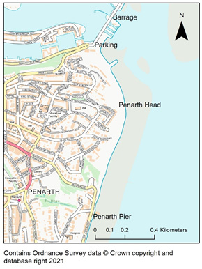
Location and access: The site is the headland at Penarth which can be reached by walking along the beach north from Penarth town or on the path along the coast from south from Cardiff Bay. The National Grid reference for the site is ST 19178 72003.
When to go: At low tide so that you can keep away from the base of the cliffs. Fossils are mostly found amongst the lose rocks of the beach which are covered at high tide.
Caution: The rocky can be slippery when wet or seaweed covered. Some of the boulders on the beach are loose and unstable. Be careful when you walk on the beach and stay away from the base of the cliffs and from the edges of the cliffs as they are loose and overhanging in places and fall from time to time. You need to check the tide tables as on spring high tides you can get cut off.
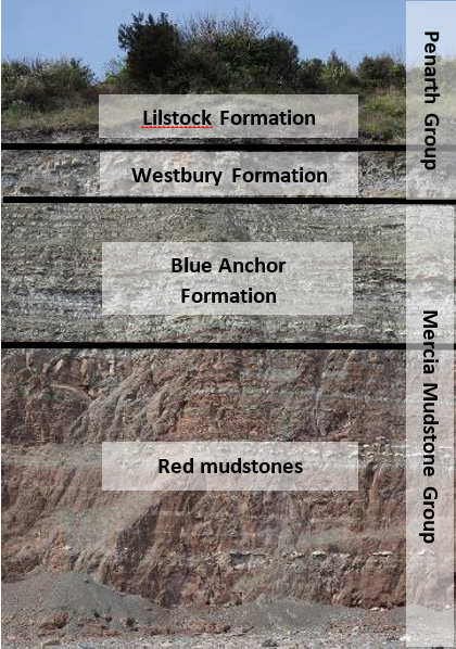
For the most part, the cliffs at Penarth Head comprise beds of striking red and green dolomitic/calcareous mudstone with bright bands of white and pink gypsum, deposited during the upper part of the Triassic Period (225- 200 million years ago), when this part of Wales was an arid desert with an eroded hilly landscape on the northern margin of an ancient sea. These rocks, which make up the Mercia Mudstone Group, and their sediments mostly accumulated in lakes which periodically evaporated under the hot desert sun. Gypsum, the hydrated form of calcium sulphate, was precipitated as a sediment when the shallow lagoons, which contained calcium sulphate, partially evaporated in the hot climates.
Geological Formations at Penarth Head
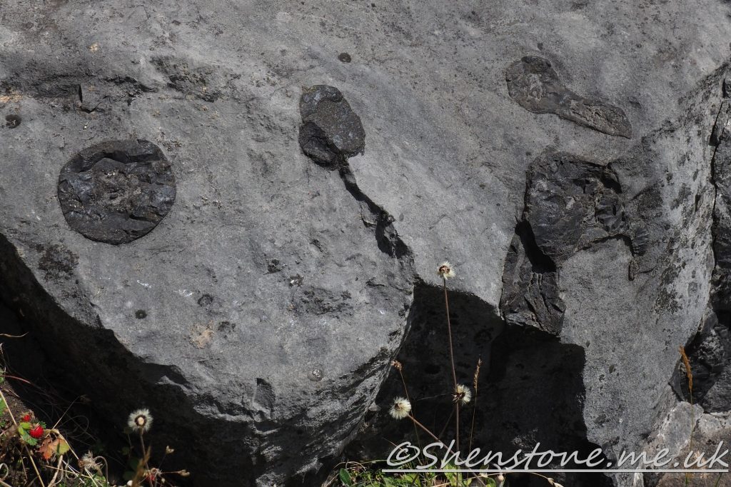
Towards the top of the cliff, the grey coloured rocks record a gradual change from a terrestrial lacustrine (lake) environment to marine conditions. These rocks are known as the Penarth Group which comprise beds of mudstone and limestone. Of especial interest amongst the formations which make up the Penarth Group is the Westbury Formation which contains a ‘bone bed’ in which fragments of fish bone and tiny black shiny teeth and be found (there are three bone beds but the basal one is the one with the most bone, the others being mainly all fish). Look out for these amongst the pebbles on the beach as well as slabs of fossilised ripples from the Lilstock Formation.
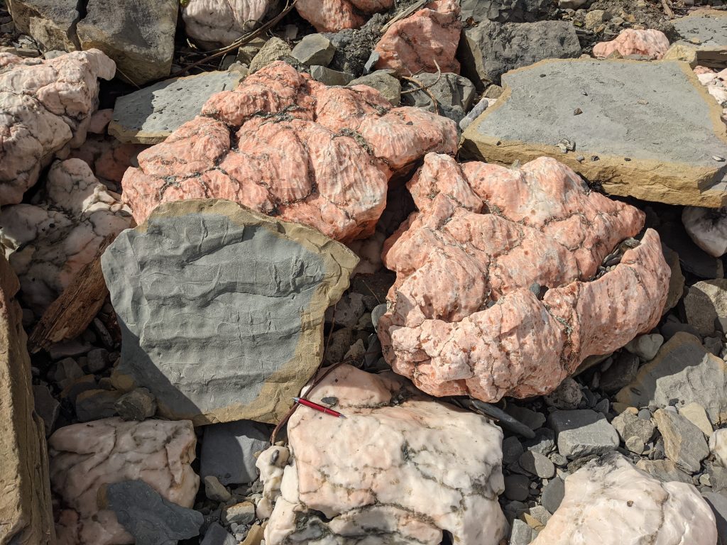
Gypsum and ripples
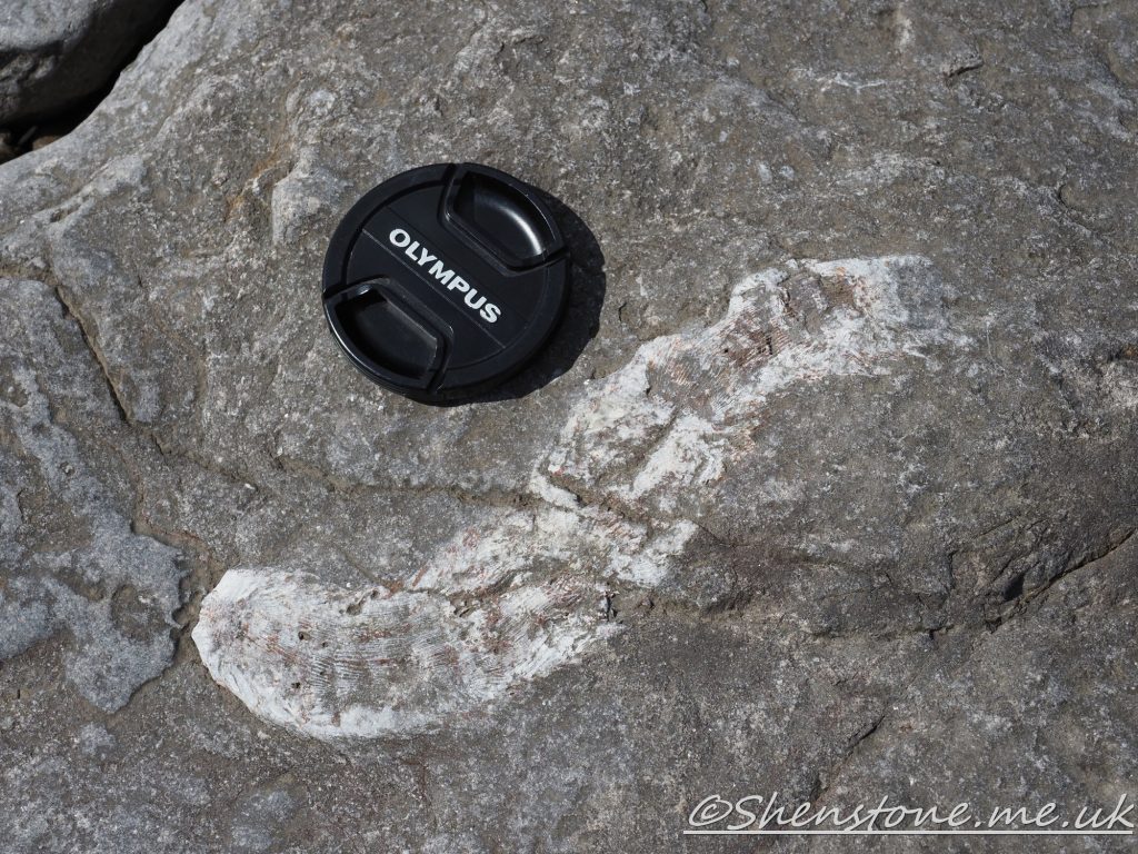
On the beach, most of the pebbles are formed of Lower Jurassic aged limestones and mudstones which are best seen further south of Penarth Head where the Lias Group makes up more of the cliffs. These are the dominant pebbles because they are much harder than the Triassic material, which is easily eroded away. Within these pebbles are many fossils. Two very distinctive ones found here and along the coast of the Vale of Glamorgan are Gryphaea and Plagiostoma but there are many others to find such as: burrows, ammonites like Schlotheimia and Psiloceras, other bivalves such as Modiolus, Liostrea, Cardinia and Chlamys. You may even be lucky enough to find ichthyosaur teeth and vertebrae or fish coprolites!
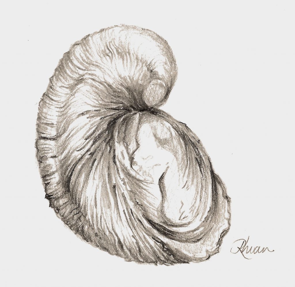
Gryphaea
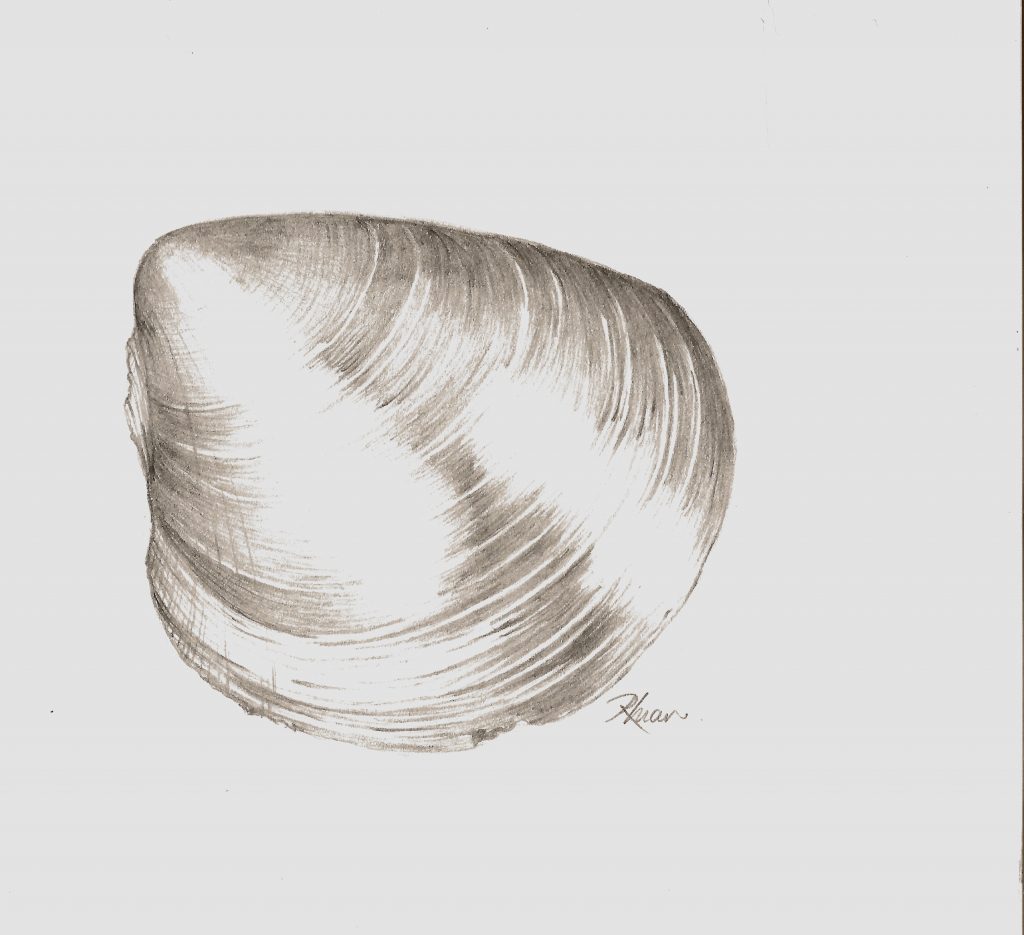
Plagiostoma
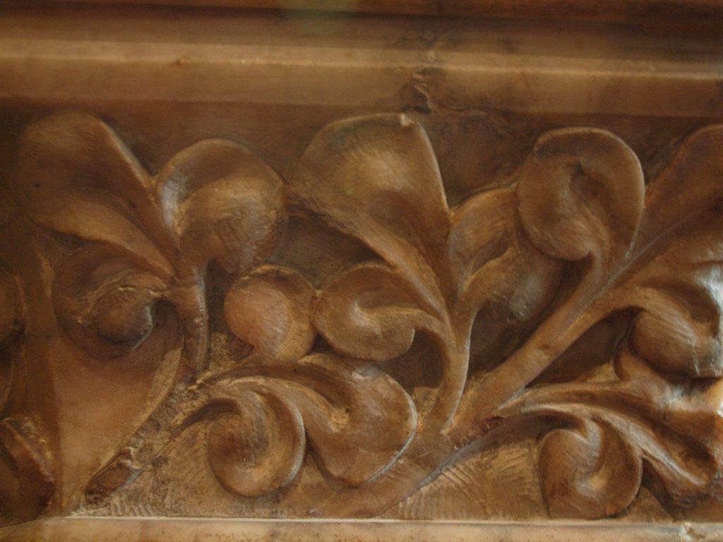
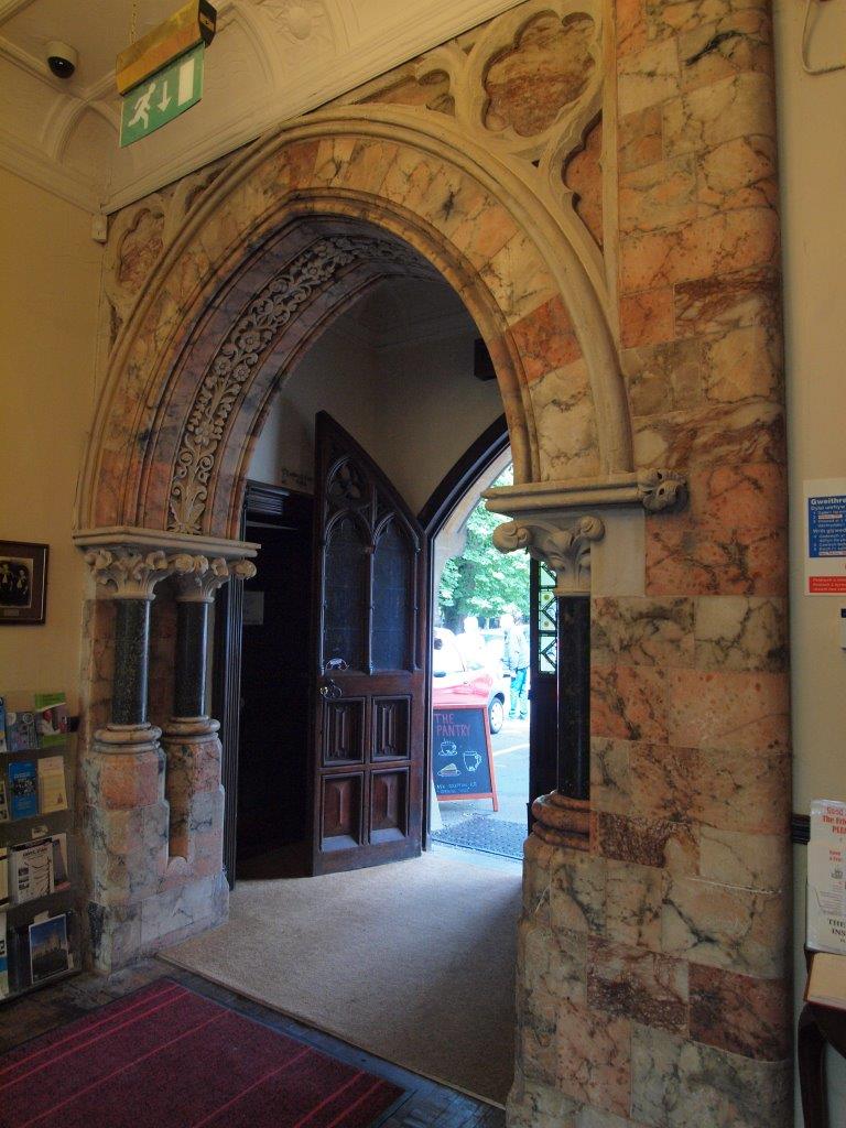
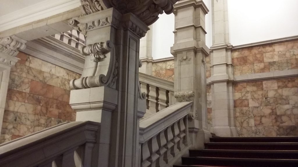
The gypsum layers seen at Penarth Head and the surrounding area are also known as Penarth Alabaster and this has been worked at least as far back as the 17th Century. Examples of its use as an ornamental building stone can be found across south Wales and beyond. Examples include the main staircase in Cardiff University’s Main Building, a doorway inside the clock tower and the spectacular smoking room at Cardiff Castle (remodeled by William Burgess and the 3rd Marques of Bute). At Insole Court in Llandaff, Cardiff, it is put to use in number of ways including a stone balustrade, window arches, columns and fireplaces. Another interesting example is at St. Margarets Church in Roath, Cardiff, where it is extensively (and probably also expensively!) used in the walls of the nave, chancel, sedilia and pulpit. This church contains the mausoleum of the Bute family.
Pulpit St Margarets Church, Roath, Cardiff
St Margarets Church, Roath, Cardiff
The entrance hall at Insole Court
The staircase in Main Building of Cardiff University
If you would prefer to download download and print this walk, please download here
•Be a Geological Detective. Cindy Howells. South Wales Geologists Association. www.swga.org.uk
•M Statham. 2017. Penarth Alabaster. Welsh Stone Forum
•Waters, R.A., Lawrence, D.J.D. 1987. Geology of the south Wales coalfield, Part III, the country around Cardiff. 3rd Edition. Mem, Br. Geol. Surv, Sheet 263 (England and Wales). www.bgs.ac.uk
We hope you enjoyed this short tour of Penarth Head. If you’d like to learn more about our local geology, take a look at the South Wales Geologists’ Association website: www.swga.org.uk